Pages

Tuesday, December 31, 2019

The Eden School

Eden School marker stone
We've covered quite a few, if not most, of the old, 19th Century schools of Mill Creek Hundred. These schools sat one to a district, and the districts (as they were in 1868) can be seen in the colorful map in the upper right-hand side of the page. The first of these districts were created as a result of the Free School Act of 1829, which was the first real attempt to make education available for Delaware children. The districts were each designed to hold about 35 students, with a small schoolhouse in which they would receive their rudimentary education. The funding to build the school and pay the teacher (from what I can tell there usually was only one per school) was derived from a school tax paid by the residents of said district.

However, as you can imagine, education in Delaware and in Mill Creek Hundred specifically did not begin in 1829. Although fewer in number than in later years, there were schools prior to the Free School Act. An earlier attempt at school funding created a fund for schools for poor children, with the money coming from marriage and tavern taxes. (Maybe because marriage and drinking are the two most common causes of children??) However, this was A) underfunded, and B) parents were reluctant to send their children there, in the process admitting they were indigent. If there was such a school in MCH, I am unaware of it.

Another, more common type of school was the subscription school. It was sort of like a local private school, with families paying a monthly tuition to the teacher. In reality, I don't think it was much of a transition into the public school system, with the school tax being just a mandatory "tuition", and the school board commissioners acting as middlemen. (And it should be noted that all these were, of course, only for white children.) The only such subscription school I had been aware of was the one founded in 1808 near Old St. James Church, west of Stanton. However, the story of another old school was recently brought to my attention.

Tuesday, December 17, 2019

Myrtle Emma -- Christmas Stories

Six of the Morris kids, c.1930
Just in time for the Holidays, I have a few Christmas-themed excerpts from our memoirist, Myrtle Emma White. Christmas was certainly a big deal then (1920's/1930's), but definitely not the all-out commercial extravaganza that it is now. And for a rural family with eight kids and limited resources, Christmas was less about getting lots of stuff and more about family, making things as special as you could, and enjoying what you did have. As a parent myself, I feel confident in saying that Frank and Elizabeth Morris did everything they could to make it as special as possible for their children, while secretly wishing they could do more. I also feel confident in saying that their children were raised well enough to appreciate what they had and not to be upset that they didn't have more. It probably helped that likely none of their friends or schoolmates had much more than they did. Again, the experiences of the Morris family are noteworthy not because they are unique, but because they aren't. Their story is the story of countless other rural families of the time.

The first of Myrtle's stories is about Christmas breakfast. It's a short segment, but in it you can really feel how much the family looked forward to this time together. The second passage is actually an excerpt from a larger chapter entitled The Seasons. We'll see the rest of it another time, but here I've included Myrtle's remembrances of the Fall/Winter holidays -- Halloween, Thanksgiving, and of course, Christmas. I find interesting Myrtle's takes on the first two, and how different they are from ours now. For her, Halloween was far from being the fun/candy/dress-up time that my own four year old looked forward to for months this year. Instead, she was so scared that she hid away, not participating at all. And Thanksgiving was "just a day home from school". They had a nice meal, but it was not the big, get-together-with-family holiday we know. I feel like that may not have fully formed until after WWII, when car travel was more universal and more easy. (Granted it was a few decades earlier, but in a previous post we saw that John W. Banks threw a party on Thanksgiving night in 1884, never even mentioning that it was Thanksgiving.)

Myrtle's recollections of childhood Christmases tell of joyous, though not extravagant, affairs. I don't know how many of today's kids would find it sufficient, but it sounds pretty good to me.

Friday, December 6, 2019

White Clay Creek School -- District No. 36

Postcard showing the White Clay Creek School
In the past we've taken a look -- sometimes in-depth, sometimes in a more cursory manor -- at most of the 19th Century schools that educated the children of the farmers, laborers, and artisans of Mill Creek Hundred. There has been one that I've skipped over so far, partially because I didn't much information about it, but mostly because I had never seen a photograph of it. One of the real joys about continuing to write the blog (when I thought I would run out of topics years ago) is that you never know when something wonderful will come out of the blue.

A few weeks back, Mary Torbey showed me a postcard she had recently purchased, which was labeled as "White Clay Creek School Building". I had never seen this particular one before, but I was pretty sure I knew what it had to be. The White Clay Creek School, District No. 36, stood for many years along the Capital Trail, the Road from Stanton to Newark, the Road to White Clay Church, or any of the many other things this stretch of road has been known as over the years. Although I knew where it had been, I did not know when it was built, when it closed, or when it was torn down. I figured I might be able to find out some more about it, but the first order of business was to verify that the schoolhouse on the postcard truly was the District No. 36 school.

As stated, the school stood on the north side of the main road to Newark, just east of Polly Drummond Hill Road and White Clay Creek Presbyterian Church. It is clearly seen on the 1849 map below. The trick to the current location, though, is that this stretch of the old road dipped south of the current path of Kirkwood Highway (as highlighted in yellow below). Therefore, the school sat south of Kirkwood Highway, as it so happens, on the property of a current school -- Shue-Medill Middle School. Its location is circled in red in the bottom photo below.

Tuesday, November 12, 2019

Myrtle Emma -- Father's Car and The Corn Roast

Brother Will at the wheel
In the latest installment in our look into Myrtle Emma, the memoirs of Myrtle Emma White, we find two stories both timely in their own ways. First up is Father's Car, wherein Myrtle tells us about...well...her father's car. It was a Velie Touring car, probably from the early 1920's. The Velie Motors Corporation made lower price, high quality cars from 1908 until 1928. It was founded by Willard Velie, a grandson of John Deere (yes, that John Deere).

The drive Myrtle mentions -- to her "father's parents' and his sister who lived with them" -- was only about five miles. James and Martha Morris lived on a farm near Ogletown, I believe right about where the intersection (interchange, really) of Rts. 273 and 4 are now. James died in 1917 (before his granddaughter Myrtle was born), but Frank's sister Laura lived with their mother, and that's who Myrtle would have been bundled up in the back of the car to see.

In this story, Myrtle also mentions that her father worked for the Newark China Clay Company. Much more information about that business can be found in a recent post. And to tie everything together, the top picture here shows Myrtle's younger brother Will at the wheel of his father's Velie. As an older boy, William Morris would work with his father at the clay company, working as a "bucket boy". Also, after the story you'll find another photo of Frank Morris and his car, in front of their Pigeon Hollow Road home. Myrtle is standing off to the side, and behind them is the (by then) former Eastburn Store. There will probably be an updated post at some point about both homes. In the meantime, enjoy the short but sweet Father's Car.

Thursday, November 7, 2019

Walker Farm Mystery Structure

The old stone...something
Whether you're a kid or a grown-up, there's no denying the excitement of being out in the woods and finding some old ruins. To know that sometime...a long time ago...someone built and lived in or worked in a beautiful, dignified building, of which you now see only the remains. It might have been their home, or their barn, or maybe a mill. If it's smaller it could have been an outbuilding, a springhouse, or a root cellar. Often, if you know what you're looking for, you can make a pretty good guess at what it was before it fell into the state of disrepair in which you find it now.

Sometimes, though, for one reason or another, identifying the former function of the stones, concrete or timbers you see can be tricky. There might not be enough left standing to tell for sure what it was. Or maybe its location just doesn't seem to make sense, or perhaps you've heard stories about it that don't really fit with what you're looking at. What can make this even more frustrating is when the said ruins are actually on or next to your own property. Such is the case with the stone building seen here, tucked between houses just a few yards from the northern edge of Mill Creek Hundred.

This beautiful and mysterious little stone structure sits along what is now a private driveway, but which once was part of a now-abandoned stretch of Doe Run Road. It lies just past where the road first branched west above Little Baltimore Road, as seen in the diagram below. It sits on the east side of the road on what was for many years the farm owned by the Walker family.

Tuesday, October 22, 2019

The Newark China Clay Company

It's been fairly well documented that from the mid-1800's through the early 1900's, the mining of kaolin clay was big business in and around the Hockessin area. We touched on it a bit in a post about the Diamond State Kaolin Company. But kaolin mining wasn't just restricted to the immediate Hockessin vicinity, as we saw in a post mentioning the Peach Kaolin Company, which was located on Paper Mill Road. And apparently that vein of clay continued westward, at least through the area just beyond Corner Ketch Road. In that spot (now part of White Clay Creek State Park), for more than 30 years, the Newark China Clay Company extracted and processed kaolinite for multiple uses. One of its employees in the 1920's and 1930's was Frank Morris, father of our memoirist Myrtle Emma White.

However, the story of the Newark China Clay Company begins not with Morris but with Victor Ullmann, a Swiss immigrant who came to this country in 1892. Ullmann was a man of many pursuits, but his most valuable one was a widow named Louisa Graham. Her value came (in addition to being a wonderful woman, I'm sure), not from her married name of Graham but from her maiden name of Stoeckle. Louisa was the daughter of Joseph Stoeckle, owner of the Diamond State Brewery in Wilmington and one of the wealthiest men in the city. Ullmann worked first for the brewery as a cooper and then as the head of its barrel-making shop. But in 1904 he and his brother Henry became involved with the Mineral Products Manufacturing Company (MPMC) of Philadelphia, and convinced them to move their plant to South Wilmington.

Tuesday, October 8, 2019

Myrtle Emma -- The Neighborhood

Myrtle's Neighborhood
In the latest installment in our look at the memoirs of Myrtle Emma White, we get her recollections of several of the families who lived near the Morris family and their home on Pigeon Hollow Road. The map to the right shows where each of the families lived. At the end, I'll have a few notes and some quick background on a few of the people Myrtle mentions. Enjoy!

Monday, September 30, 2019

Stanton's Forgotten Mill

Approximate bounds of the 17 acre lot sold by
Isaac Hersey in 1733
Today we think of Stanton as little more than a loosely defined area, anchored by the ever-growing intersection of Newport Pike (Rt 4) and Limestone Road. But in the 19th Century, Stanton was a thriving village with industries of its own, and always seemed to be on the verge of growing into a full-fledged town and industrial center. The recently posted newspaper article/love letter from 1887 perfectly encapsulates this feeling, that Stanton was about to turn into a boom town. As I think we all know, that never happened. It did, however, remain as an economically healthy village.

In the post-Civil War era, in addition to the usual village businesses (taverns, shops, blacksmith, cobbler, etc.), Stanton had in or near it a merchant grist mill, a bone mill (it ground animal bones for fertilizer), and three textile mills. One of the textile mills was the Kiamensi Woolen Mill located below Marshallton, and it was associated with the Independence Mill that stood near the Hale-Byrnes House just southwest of the village. There was, however, a third woolen mill, located even closer to the heart of Stanton. At one time it was the largest, closest industry to the village, yet because it vanished years before the others did, it's been largely forgotten.

It stood, for about 150 years, just behind where the Walgreens is now, across from the end of Telegraph Road. The very early history of the tracts in this area is quite murky, but we do know that in 1723, French emigree Isaac Hersey purchased at a sheriff's sale much of the land below Stanton. In 1733 he sold an approximately 17 acre piece of it to Simon Thetford, who in turn sold it about a year later to Thomas Gray. In 1738, Gray sold the tract to James Guthery. In none of these sales is a mill mentioned, so we can infer that it was Guthery, sometime after 1738, who erected the first mill at this site. It was presumably also he who dug the almost mile and a half long race that began on Mill Creek above Old St James Church. Guthery owned the mill property until 1771, when he sold it to Caleb Harlan and Joseph Pennock.

Monday, September 23, 2019

Stanton: A Town Long Asleep [Not] Beginning to Wake Up

While researching some of the mills in the Stanton area, I came across a story in the Wilmington newspaper The Daily Republican, which ran on January 27, 1887. Ok, it's really not so much of a "story" as it is part love letter to and part Chamber of Commerce propaganda about the village of Stanton. Stories like this were not totally uncommon, and I suppose they gave the paper's mostly urban readers a taste of what the outlying towns and villages were like. Maybe they sometimes go overboard, and feel like they should end with "Schedule your next trip there today!!!"

Instead of showing the original article (which can be hard to read here), here following is a transcription of the entire piece. Some of the people and places may be familiar to you, or they may not. Afterwards I'll have a few things to say about the article (because, of course I will). Here it is in all its glory:

Monday, September 16, 2019

Myrtle Emma -- A Walk to the Store and The Tradesmen

Dempsey's Store, c.1880's
In another installment in our ongoing look at Myrtle Emma, the memoirs of Myrtle Emma White, we'll look at two chapters, with commerce being the unifying theme. The first piece is entitled "A Walk to the Store", and it's about...um...a walk to the store. The second is called "The Tradesmen", and in this piece Myrtle talks about some of the vendors, salesmen, and other colorful characters that would occasionally pass through their little corner of Mill Creek Hundred.

The store that the Morris girls walked to one nice Saturday (and countless other days, to be sure) was Dempsey's Store, at the corner of Corner Ketch and Doe Run Roads. It's almost exactly one mile from their house on Pigeon Hollow Road. In 1885, John T. Dempsey, Jr. purchased about 38 acres from Victor du Pont (which du Pont had just purchased at a sheriff's sale) and opened a store, in addition to farming. In 1921, he sold the property to his son George W. Dempsey, so the Mrs. Dempsey referred to is probably George's wife Louise. The school and the lodge building mentioned by Myrtle will be addressed in future posts. The Dempsey property, while no longer a store, is still owned by the Dempsey family.


A Walk to the Store

It was a Saturday, a nice day weather-wise. Mother needed some things from the store. She asked my older sister Maud and me to go. Our little brother Will would have liked to tag along, but he was cutting kindling for the black cook stove, so we went without him.

The store was a long walk. My sister carried the folding money and grocery list. We passed lanes with farm houses in the distance and mail boxes standing at attention with their red flags down. We passed the sheep farm with the collie dog running along inside the fence, barking because we were strangers. We passed the barn and saw a flock of sheep in the meadow. They stood in their tracks watching us pass. Next came the school house lane and more farm houses with trees that overhung the road. We slowed down and enjoyed the shade. Over the hill we saw the big lodge building where our parents went on Monday nights.

Tuesday, September 10, 2019

Myrtle Emma -- Home

Myrtle, Bill, Frank, Mother Elizabeth,
and Duke, in front of their Pigeon
Hollow Road house
This is the first installment of Myrtle Emma, the memoirs of Myrtle Emma Morris White. It's the longest of the pieces she wrote, but one of the most interesting and informative in terms of understanding "pre-modern" Mill Creek Hundred. I find it fascinating and important not because the life she's describing is unusual, but precisely because it's not. Although the Morris family were not farmers, their lifestyle would have been very similar to most residents of MCH from the early days until World War II or later. These writings are special because they give an amazing insight into how most people lived "out in the country", before electricity, plumbing, sewage, and for the most part, paved roads.

The house described in this piece is located on Pigeon Hollow Road, on the right side of Corner Ketch Road just above Paper Mill Road -- behind where Whiteman's Garage stood for many years. We'll talk more about the area in an upcoming segment, but I can reassure all that the Morris' stone house is still standing, and in fantastic shape. The current owners have done an amazing job with it, keeping the original structure and adding a large but tasteful addition in the rear. The stucco evident in the old photos has been removed, revealing the beautiful stone beneath. The front door has been removed and seamlessly filled in. The house is certainly historic, dating to at least the early 1800's. I hope to have more information on it in the near future. In the meantime, enjoy "Home", by Myrtle Emma White:


Home was a two-story stone house with an attic, a garage, and a porch. I lived there with my mother, father, three brothers and four sisters. It was shared space and belongings. There was no electricity or indoor plumbing.

By the front door, in a good spot for the light, was a washstand with a marble top. On it sat a water bucket and dipper, and a mirror hung over it. In the drawer were combs, toothbrushes, and shaving razors. A razor strop hung by the mirror and a rolling towel rack hung beside it. Behind the doors at the bottom were a wash basin, towels, wash cloths, and soap.

Thursday, September 5, 2019

An Introduction to Myrtle Emma

Myrtle Emma Morris White
While I don't have anything as formal as a Mission Statement for the Mill Creek Hundred History
Blog, ever since I started writing it about ten years ago I've had a few different purposes for it in mind. First, and most obviously, it's a place for me to write about the topics I'm learning about myself and to put the information out there for anyone else who might be interested in it. I was hoping that there was an intellectual market for it, and I've been thrilled, humbled, and grateful for the following I've had over the years. However, it's always had another purpose, and it's one of the reasons I like the blog (and Facebook) format.

Since the beginning, I've tried to make and allow the blog to be a forum, a gathering place, a place where everyone else can also contribute their own personal knowledge and ask their own questions about our local history. I've always been very excited whenever someone contacts me with an old picture of theirs, whether they know the whole story behind it or not. I've been honored to share the many guests posts that others have written for us. And frankly, over the last couple of years, I'd say that most of the post topics have come directly or indirectly from questions, comments, or suggestions from readers. This has been a very rambling way of saying that I have another such item to share with everyone -- one that will flow out through several posts spread out over the next few months. It's also one that I hope might inspire others like it.

Thursday, August 15, 2019

The Trolleys of Brandywine Springs -- The Kennett Trolley

A Kennett trolley passing by Lake Washington
at Brandywine Springs Amusement Park
In the last post, we looked at the Peoples Railway Company, formed by Brandywine Springs Amusement Park manager Richard W. Crook with the main objective of providing the residents of Wilmington and beyond with easy, cheap, quick access to the park. It did a fine job of that, and allowed the park to flourish during its decade and a half heyday from about 1901-1915. That being said, it actually barely made its way into Mill Creek Hundred, with the exception of the Marshallton spur, and even that was barely in the hundred. There was, however, another trolley line built to service the park, and this one had well over five miles of track in MCH.

In May 1899, the West Chester, Kennett, and Wilmington Electric Railway Company (WCK&W) was chartered with ambitions not quite as grand as its name, and a future that would be even less so. It never ended up getting anywhere near West Chester, and only made it to Wilmington for a very short time and with the help of the Peoples Railway. The original plan was to connect to the Peoples Trolley at Brandywine Springs, build a line northward through Kennett Square to Unionville, and connect with a proposed extension of the West Chester Street Railway. Only part of that plan actually happened.

The WCK&W first had to wait for the Peoples Railway to be built, and as we saw in the last post that did take a few years. Once they knew it was "on", the first proposal was to build a line from Kennett Square through Avondale and West Grove, terminating in Oxford. Long story short, by 1906 the line had extended to West Grove, but never made it any further west, and never got anywhere near Oxford. The line that interests us was completed in 1903, with service first being available from Kennett Square to Yorklyn in May 1903. By August, trolleys were running from Brandywine Springs all the way to Toughkenamon. In contrast to the Peoples Trolley's 5 cent fare, the ride from Kennett to the park would cost you 20 cents.

Tuesday, August 6, 2019

The Trolleys of Brandywine Springs -- The Peoples Trolley

Doing its job advertising the park
Of the three trolley lines that once made their way into Mill Creek Hundred, two of them were created primarily to shuttle passengers and park-goers to and from the Brandywine Springs Amusement Park. It would be hard to talk about the two lines independently, and pointless to discuss them with out also including the park. We've discussed the park before -- how it started as a resort hotel in the late 1820's, then operated mid-century as a smaller hotel. In 1886, Richard W. Crook took over the hotel and slowly changed the property from a hotel to an amusement park. In the waning years of the 19th Century, he realized what his park needed to thrive into the 20th -- a trolley line that would make it easier for the city-dwelling folk to visit his park out in the country. This would turn Brandywine Springs into what amounted to a trolley park in reverse.

Trolley parks were ubiquitous in the late 1800's and early 1900's, with well over a thousand dotting the national landscape in the early part of the last century. They were built by the local trolley companies, out at the end of their lines usually on some sort of water (a lake, river, or creek), to serve a couple of purposes. First, in an age when the trolley was many people's primary transportation to and from work and school, the parks helped to boost ridership on the weekends. The second purpose had to do with that great advancement of the age, electricity.

While many started out horse-drawn, by the 1880's trolleys were electrically-powered. The trolley companies either paid a flat rate for their electricity, or more commonly, generated it themselves. The power cost them money either way, so they might as well have the trolleys running as much as possible. Plus, in the days when electrification was still an ongoing concern, the trolley parks would be lit-up as much as possible, dazzling their guests with the modern miracle of electricity. For example, the Brandywine Springs' entrance archway was covered in lights, and lit at night was probably the most lights that most guests had ever seen in one place before. So whereas in a traditional trolley park the line existed first and then the park was built, at Brandywine Springs the opposite was true.

Wednesday, July 17, 2019

The Walker-Maclary House

The Walker-Maclary House
If you've read a few of these posts before (especially some of the more recent ones), you'll have noticed that there are two different aspects to researching and telling the story of any given property. First, there's the chain of ownership of the land itself, as documented in the various deeds and indentures. With the resources I have available to me now, that part is relatively easy and I've gotten pretty good at it, for the most part. I've even gotten better at mapping out the metes and bounds of some of the tracts (Do you know how long a perch is? I do, and I don't think I'll ever forget it now).

But it's the second part that's often the tricky and more frustrating one -- trying to determine exactly when a particular house was built, and therefore, by whom. I've taught myself a little over the years, but I am definitely not an architectural historian. Unless there's some sort of contemporaneous report of construction or a reliable date stone, we're often left to detective work and guess work. That usually entails judging the style of the house for a likely era, and seeing who owned it then to determine who might have built the house. In this case, though, we're fortunate enough to have a story passed down about part of a home, albeit a second-hand story. (Ironically, the house was only one story.)

The property I'm referring to is located at 4925 Old Capitol Trail, in the middle of Penndrew Manor, near Old St. James Church. I usually don't use street addresses, but in this case the house has already been referred to by the address in a previous post. However, after researching the history of the property, I've chosen to call it the Walker-Maclary House for reasons that should soon be apparent. And it's from information obtained relating to the previous post that we get the story about part of the house. This is also an example of how a property doesn't have to date back to the 1700's to have an interesting history.

Wednesday, June 19, 2019

The Levi McCormick House

The Levi McCormick House
Back in 2012, I wrote a post about the Randolph Peters Nurseries, located on the western end of Mill Creek Hundred. I now want to revisit not Peters, but the house shown here and on that post, which at the time I very hesitantly said might have been his. Thanks to inquiries from the current owner of this beautiful home and much better information available this time, I can now unequivocally state that this was not Randolph Peters' home, although it was in his family for a short time.

This is what I've chosen to call the Levi McCormick House, although the history of the land (and almost certainly of the house) goes back much further than McCormick's arrival in 1879. The farm was originally part of a larger tract that extended all the way up to Possum Park Road, but was down to about 105 acres by the time Nivin Caldwell acquired it sometime before 1777. Caldwell died in 1787, and in 1795 his widow Agnes sold a tract of about 72 acres to another widow, Mary Black. The farm was approximately the shaded area seen below, located east of Newark and on the north bank of White Clay Creek.

Thursday, June 6, 2019

Spring Grove Mills and Estate -- Part II

The Spring Grove Mills Estate today
In the last post, we followed the story of the Spring Grove Factory from its beginnings as Henry Brackin's grist mill, through its history as a cotton and woolen mill under various owners. When we left it, the factory had been converted back to woolen production under owner Aquila Derickson. And after Aquila's passing in the early 1880's, the property was sold to one of his sons, Joseph W. Derickson. Although many of the facts are clear, there is a glut of confusing information about what exactly was going on during the 30 or so years the Dericksons owned Spring Grove, especially during the 1880's.

We get some frustratingly incomplete and at times contradictory details from several sources. Of Calvin Derickson, J.M. Runk in 1899 says that he was involved in the manufacture of spokes (which we knew) and in the wool and cotton business with James Ford. I do not know who James Ford was, nor does his name show up anywhere else. Of Joseph, Runk has this to say: "For a period of ten years he operated the Spring Grove mills, manufacturing silk and woolen yarns. The mills were destroyed by fire in 'the fifties', and he sustained a loss of more than five thousand dollars." The last part is just wrong, as we know exactly when the mill was destroyed, and it wasn't in "the fifties". If there was a fire then, it was before the Dericksons were involved and it was rebuilt. But, it does give us our first mention of silk being made here. Now read what Scharf has to say about the site:

Tuesday, June 4, 2019

Spring Grove Factory and Estate -- Part I

Spring Grove, taken by Charles Philips, 1895
Many of the recent posts here have been about families and their farms, but as we all know, this ain't Farm Creek Hundred, it's Mill Creek Hundred. It's been a while since we've taken a look at one of the many mills that one graced our region, and one of the main reasons for that is that I've already written about most of the major mills that operated here. There were, however, numerous smaller mills around that operated for varying lengths of time, and about which we know very little. This is the story of one such mill -- Spring Grove. This is a fascinating story, with only a few small holes remaining in the narrative.

I've known of the existence of the mill for quite a while, but I had been unsuccessful in finding very much information about it, until recently. Through my own research and through the amazing and detailed research of the site's current owner, David Deputy, we've come up with an almost complete history of the site, the mill, and the house built next to it. And what a story it is!

We begin in the days prior to the American Revolution, when Henry Brackin, Sr owned a large tract of land along what would become Stony Batter Road, as well as an old sawmill built along Mill Creek. His land actually stretched slightly across Mill Creek, and it was on or very near the southeastern portion of Henry's farm, very near that sawmill, that on September 8, 1777, British and American sharpshooters traded shots as the invading Red Coats camped along Limestone Road. This event would be known as Gen. Weedon's Foray, and was uncovered by Walt Chiquoine during his research for his paper Finding the Nichols House. When Henry died in 1779, his property went to his son Henry Brackin, Jr.

Tuesday, May 21, 2019

Billion Gallon Border: Part II - The Old Mill Stream

In the last post, guest writer Robert Wilhelm began telling us the story of Hoopes Reservoir by first relating the tale of the Red Clay Creek reservoir that never was. In this post, he tells us of the background and construction of the reservoir that was created, and a bit of what once stood where the water now is.

-- Researched and written by Robert E. Wilhelm, Jr

Hoopes Reservoir, 1933
An alternate reservoir location involved Old Mill Stream, a tributary of the Red Clay Creek in Christiana Hundred and the location of the present day Hoopes Reservoir and Dam. A dam constructed across the Old Mill Stream valley could contain water at a higher level (~ 225’ water surface elevation above sea level) than a dam associated with the Red Clay Creek Valley (~180’ water surface elevation above sea level if a reservoir was to remain inside Delaware; 150-160 feet if not impacting Yorklyn). Holding 2-billion gallons of water, an Old Mill Stream reservoir offered greater water depth at the dam with equivalent storage capacity and less surface area as compared to a Red Clay water pool.

There was little infrastructure present in the Old Mill Stream valley which was not the case for the Red Clay Creek Valley. Within most of the 480-acre footprint of the proposed ‘Old Mill Stream Reservoir’ was the former mill property and farmland belonging to T. Coleman du Pont including Dupont’s summer home. Once an operating water-powered stone mill constructed in 1732, du Pont personally converted the idle mill into a mansion. A smaller stone mill constructed in the 1850s on the property was in ruins and would remain to succumb to the reservoir’s rising waters, while du Pont’s home would be demolished leaving only the stone walls behind.

Thomas Coleman du Pont and his wife Alice Elsie du Pont (his cousin) bought the property in 1906. By 1910 they had converted the original mill building to a rural weekend home to complement their home at 808 Broom Street in Wilmington. Called ‘Old Mill’ the original mill’s stone, quarried on the property, contained quartz, mica, and garnet speckles that the du Ponts left exposed on inside walls. The first floor, below grade and adjacent to the mill pond and millrace, contained the mill home’s water wheel powered electrical generating system. There was central heat with fireplaces in each of the major rooms. The second floor was assigned to the caretaker and family. The du Pont’s occupied the upper two floors with the third floor being open architecture for use as a living space or ballroom. Bedrooms and baths were on the fourth floor.

Thursday, May 16, 2019

Billion Gallon Border: Part I - The Red Clay Creek Proposal

I'm excited and proud to present here another Guest Post from Robert Wilhelm. Bob has done some great research into the origins and construction of Hoopes Reservoir, and in this post and the next relates to us the story of how it came about. But first, this post tells the story of the reservoir that wasn't -- the proposed Red Clay Creek reservoir. I think you'll agree they ended up making the right call.

-- Researched and written by Robert E. Wilhelm, Jr

Hoopes Reservoir today
The centerline of the Red Clay Creek serves as the border between Mill Creek Hundred and
Christiana Hundred. During most days, the creek is only a few tens of feet wide. In the late 1920s, a proposal was seriously considered that would have changed the Red Clay Creek’s width to hundreds of feet for nearly a third of the creek’s length within Delaware. The City of Wilmington, needing another potable water reservoir to support a growing population and industry, studied flooding much of the Red Clay Creek Valley north of Wooddale for a reservoir that spanned both Mill Creek and Christiana Hundreds.

By the early 1900s, it was apparent to Wilmington Council members that any number of events might place the city’s reliance on the Brandywine Creek for potable water in jeopardy. While the city had reservoirs, they were proving inadequate. A study, commissioned in 1919, recommended an additional reservoir of at least a billion gallons be added to the city’s water systems for use during drought, Brandywine Creek contamination, or for emergency use.

In 1924, Wilmington commissioned a study as the first step for a project to eventually construct a large reservoir outside of city limits to store water for augmenting the Brandywine’s supply. Wilmington Water Department engineers considered multiple natural landscape locations associated with the Brandywine, White Clay, Christina, Pike, Red Clay, and Mill Creeks where land might be purchased for a new reservoir. Northern New Castle County’s Piedmont stream valleys are rich in spring-fed tributaries feeding creeks. This combination results in ideal natural opportunities for the creation of water storage lakes and reservoirs.

Thursday, May 9, 2019

The History of the David Eastburn Farm

David Eastburn
When I first started writing this blog nearly a decade ago, I basically just went around and wrote about whatever seemed interesting to me in the moment. I had to think about and decide what my next topic would be. Nowadays, though, it's much more common to have the topics come to me, often stemming from contacts with readers. This particular subject, like the previous one (The Huston-Springer Houses), started with an email from the current owners of the home. In this case, it's the beautiful Italianate-style David Eastburn House on Corner Ketch Road between Paper Mill Road and Doe Run Road. I did a post about it back in 2011 wherein a gave a rough outline of the history of the property and David Eastburn himself, as best as I could determine at the time.

Well, as I stated in the Huston-Springer post, I have a lot more data at my disposal now. Prompted by the contact from the owner, I went back and was able to come up with a much more detailed history of the property, both before, during, and after David Eastburn's tenure there. So much detail, in fact, that I hardly know where to start. So let's start with David, almost certainly the builder of the house but not the first resident of the land. When I asked the current owner what he had heard of the house's history (always a crapshoot because you never know what kind of information has been kept and passed down with a property), he said he'd been told that it was originally owned by several siblings. I'm glad to say that in this case at least, the information seems to be correct.

In the original post, I make no mention of the property and only passingly state that the house was built in the 1850's, possibly around the time of David's wedding in 1857. The reality is so much more complicated than that, but I'll try to keep it as concise as I can. The first thing to understand is that the farm David Eastburn owned at his death in 1899 was acquired in four separate tracts, going from west to east. The four parcels (which I'll call Tracts 1-4) can be seen in the diagram below. My lines may not be accurate down to the foot, but they're pretty close. The house is denoted with a star and is located in Tract 1, the largest of the tracts and the first one acquired by the Eastburn family. And to circle back, it was acquired by the family.

Monday, April 29, 2019

The Real Story of the Huston-Springer Houses

The James Springer House
Author's Note: I apologize for this post running a bit longer than most. However, I felt that these two houses needed to be dealt with together, as their histories are inextricably linked. This is one of those cases where you really can't understand one property without understanding the other, and I didn't see any good place to divide it up into two posts.

There are many reasons why I enjoy researching and writing these posts (the pay not being one of them). Obviously I enjoy the history -- uncovering and giving voice to stories that have either never been told or which have been largely forgotten. I like trying to better understand the past and the people who inhabited it. But there is also the mystery and informational "treasure hunt" aspect to it. I really like starting with just a bare bones amount of information, and seeing how much of the story I can end up filling in. But as with any investigation, my ability to reconstruct the story is limited by the resources I have and the amount of data I can collect. Luckily, sometimes those limits expand over time. With more resources comes more information, and sometimes with more information comes different conclusions.

Yes, this is all going somewhere. A little more than six years ago, I did two posts about the Springers of Northern Mill Creek Hundred. It wasn't until halfway through the second post that I finally got to the two houses I had originally set out to explore. These were what I had called the Stephen Springer, Sr. and Stephen Springer, Jr. Houses, both located in Mendenhall Village, on the south side of Mendenhall Mill Road. At the time, all I had to go on was a misleading passage from Runk, some not-so-helpful censuses, and the usual maps.

From all that, I surmised that Stephen Springer moved sometime in the 1820's from his family's home in Hockessin to the westernmost of the two Mendenhall-area houses, the one off of Village Drive. I stated that this house later went to his son James, while Stephen, Jr. built the eastern house (near Pump House Circle) in 1843, after being given a portion of the family farm. I had no information on what became of either property after the ownerships of Stephen, Jr. and James.

Recently, though, I received an email from the current owners of the western home, which I had labeled the Stephen Springer, Sr. House. After looking back to see how little information I had about it the last time, I decided to take another look, this time armed with, among other things, access to historic deeds and land transfers. And wow, I'm glad I did. It turns out, some of what I wrote was correct, some of it was sort of correct, and some of it was just flat out wrong. I'm here now to correct the record, as best as I can. It's still not crystal clear, but I'll lay out the situation as I now understand it.

Wednesday, April 10, 2019

The Bellew-Cain Lot and the Yarnall Survey Map

The 1850 Yarnall Survey Map
This story all started when Marshallton-area historian Denis Hehman posted an image of an old survey map that he has in his collection. To be honest, he'd shown it to me before, but I never really looked at it very closely or did any research on it before. That was a regrettable error, because when I saw it this time, this little hand-drawn map kicked off a very fun and surprisingly in-depth investigation. And to top it all off, thanks to the wonders of social media it even connected to several descendants of players in the story, something that would never have happened with just an email between friends.

Everything starts with the map. It's very simple, but tricky to understand without any context, of which it gives very little. As its title says, it's a "Draught of Jacob Yarnall's Lots, Surveyed Oct 19, 1850 by I. Lobb." Once I took a good look at it, I knew about where Yarnall's lot was, but I was curious to see if I could determine exactly where it was/is. The biggest clues as to its whereabouts are the roads and watercourses shown. Red Clay Creek is at the bottom, with Ham Run coming down the middle of the map and the west edge of the lot. The road heading off to the right labeled as New Port Road is what we know as Duncan Road today, while the Stanton Road at the bottom is our Greenbank Road. Since Ham Rum does not extend very far, this places our lot somewhere on the left hand side of Duncan Road, if you're driving up the hill from Marshallton to Kirkwood Highway.

The next thing I did was to consult the New Castle County Parcel Search website to see if I could find any properties that might still look like this today. The fascinating thing I've found over the years doing this is that you can often find traces of property lines hundreds of years old still evident on the map today. And when I looked at the current parcels, I couldn't help but notice the highlighted one below, about halfway up Duncan Road between Greenbank and Kirkwood Highway. When I measured the area of the now three lots, they totaled just over 2½ acres -- the same as Jacob Yarnall's lot from 1850. A quick glance at the old maps showed the same name there in 1868, 1881, and 1893, but not Jacob Yarnall's. These were enough clues, however, to get me started in telling the complete history of this lot.

Tuesday, April 2, 2019

The Foote-Pyle House

The Foote-Pyle House today
In the last post, we focused on the portion of John Huey's 1725 tract that became the Mendenhall-Pierson farm. Its early 18th Century house (the county lists it as 1734) still stands on the south side of Graves Road. But just north of the Mendenhall-Pierson House, part way up Sawin Lane, is a house that the county says was built in 1729. This is the smaller of the two homes, but it could very well be the older of the two. And, as best as I can tell, it was part of the same tract purchased by John Huey in 1725. One possible explanation for the two homes is that this northern one was built first, by John, Sr., and the southern one a few years later either by or for his son.

I've done my best to trace the land under this northern house, to varying degrees of success. It may have been part of land that John Wat bought in 1762, or it might not have been. Bolstering that idea is the fact that there is a connection to John McBeath, the man who ultimately inherited Wat's land. In 1810, McBeath's son Robert sold 107½ acres to William Foote, who in 1840 sold it to his son William. The next place I lose track of it is where it intersects with the land of another family mentioned in the Mendenhall-Pierson post-- the Pyles.

In 1861, William Foote, Jr. sold 30 acres (that may or may not be the same tract we'll follow) to Cyrus Pyle. Cyrus Pyle was a leather manufacturer from Wilmington, and the son of Isaac Pyle, who owned land directly north of where we're talking about. Cyrus was also the brother of William Pyle, who was the father of artists Howard and Katherine (Katherine was the mother of Ellen Pyle Lawrence, previously mentioned as a later owner of the Mendenhall-Pierson House). In 1868, Cyrus Pyle sold 77 acres to James C. Jackson, the owner of the Dixon-Jackson House in Hockessin. The main takeaway from this is that I don't believe any of these men lived in the old, small house. The tract was almost certainly leased to a tenant farmer.

Thursday, March 28, 2019

The Mendenhall-Pierson Farm

General location of the Mendenhall-Pierson farm
After a couple of fits and starts, as well as a few (very fun) distractions, we're back to document the remaining old properties along the stretch of Graves Road west of Newport Gap Pike. However, unlike the Peoples farm we already looked at, these two properties do have historic homes still standing on them. And if the construction dates listed by the county are even close to accurate, they rank among the oldest houses in existence in Mill Creek Hundred. Although the two farms have been separate for a very long time, I'm putting them together here in these posts because originally, they were parts of the same tract. Their chains of ownership get a bit murky at times, but I'll do my best to sort them out.

The trail begins when, on January 20, 1725, a tract of 214 acres is surveyed for John Huey. It was sold to him by Reece Thomas, attorney for William and Letitia Penn Aubrey (William Penn's daughter). The tract was roughly vertically rectangular, lying to the west of the Peoples farm and south of where Sanford School now stands. It extended south of today's Graves Road, which did not exist at the time. At some point very early on, 80 acres on the north end were sold to a John Laugherty, leaving 134 acres for Huey. I've tried and tried to follow that 80 acres, so far to no success.

When John Huey, Sr. dies in the 1750's, his land is left to his son John, Jr. I think John Huey, Jr. moved away from the area, and he sold the 134 acres in 1753 to James Philips. James Philips also didn't stay long, as he sold the property in 1763 to Uriah Blue. (The Philips name would stick around through James' brother William, who owned Ocasson (The Cox-Mitchell House in Hockessin) and whose descendants would later own the Greenbank Mill.) I haven't found much about Blue, except that his wife's name apparently was Mary Jordan. A James Jordan owned an adjacent tract to the original property, so if she was perhaps his daughter, that could be a link to the area. (I admit to being oddly obsessed with trying to figure out why people bought particular pieces of land.)

Friday, March 15, 2019

Fire at the Mill Creek Road Gregg House

The Gregg House on Mill Creek Road
As you may or may not have seen, there was a fire yesterday (March 14, 2019) at the old house on the Delcastle Golf Course property, on Mill Creek Road at the bend. The house is owned by New Castle County and is part of its curatorship program, which allows tenants to rent the property for free, as long as they make substantial improvements to it. The current occupants have been there for about five years. The blaze, which preliminary reports state was an accident started in a laundry room, has seemingly done major damage to the structure. The residents were able to get out safely, but a Minquas Fire Company firefighter was injured in battling the blaze. Please send your thoughts and prayers or whatever it is that you send out to wish him a speedy recovery. I still don't understand the heroic mindset that allows people to run towards a burning building, but I'm thankful for all those who do.

When I saw this story, my first reaction was the same as that of Ann DePace Keen who contacted me -- What is the history of this house? My quick answer to both of us was a resounding, "I'm not quite sure." When I wrote about the earlier history of the Delcastle property almost five years ago, I deftly avoided mentioning this particular house. The reason I danced around it is that the history of the house is not quite clear. As you can see by the pre-fire picture below, the house is clearly old. The question is, how old?

Friday, February 1, 2019

Mill Creek Hundred Tax Books

1839 MCH Tax Book
Sometimes I lose sight of the fact that this might not always be obvious to you, but normally when I consult primary sources (like census records, land transfers, death certificates, etc.) I very rarely actually have the original documents. Like, almost never. Usually when I say something like, "I found the 1875 deed..." what I mean is I've found the image of it on a website like Ancestry. There's nothing wrong with that. I am seeing an image of the original document, so I can gather whatever information I need from it myself, without having to worry about getting it secondhand through someone else. Because, no offence (I'm not talking about you), sometimes other people are dumb. Sorry, I meant unreliable. Still don't mean you.

Frankly, I wouldn't be able to do any of this if I had to actually go out and hunt down each document I needed individually. I don't have the time, gas money, or energy for that. This blog could not have existed before the internet, and not just because where would I have put it? Having said that (and having used up about a minute of your life doing so), once in a while I'm lucky enough to actually get my hands on original, true, honest to goodness historical documents. Thanks to the generosity of some wonderful people and the foresight of their ancestors, this is one of those times.

This is also a story of serendipity, great timing, and a fortunate coincidence. After having been contacted by Dick Joyce, and while in the midst of researching the Graves Road area (of which the Peoples Farm post became the first), I got another email that would help to focus my investigating. This one came from Bob Pigford, on behalf of himself and his wife, Patsy. Patsy's mother, Helen Pierson Houchin, had passed away early last year at the age of 96. In going through her belongings, they came across several items they thought I might be interested in. I was, very much, and you'll find out more about two of them in a moment. But first, I'll explain why their contacting me was so fortuitous and coincidental, and it works on at least three different levels, all having to do with Patsy's family.

Thursday, January 24, 2019

New Updates on Harrison Smith, W. L. Edison, and E-Mail

One of the most fun aspects of the investigations I do here is the fact that none of them are ever really
done. For better or worse, there are always more questions to answer and more mysteries to ponder. A regular part of the process involves sometimes going back and adding new information or some additional thoughts, whether it be a few days later or six years later. Here we've got a little of each, plus a technical addition that may or may not be of interest. Either way, I wanted to make sure you were aware of it all.

The first addition was to a very recent post, the one about the Benevolent Order of the Sons and Daughters of Harrison Smith. About a day or so after posting this story, some new information about Harrison Smith was brought to my attention that got me thinking a bit more about him, and his relationship to the group or groups. I also thought a little more about the timing of various events. These musings can be found at the end of the original post, which can be found here. If you read the post when it was first published, go back and check out the additional thoughts I added on.

Sometimes updates happen pretty quickly, and sometimes they don't. The next update was made this week, to a post originally published over six years ago. The story was about William L. Edison, the son of inventor Thomas Edison. I had found newspaper ads stating that the younger Edison had lived near Greenbank and had operated a car dealership, either there or someplace else. There wasn't a whole lot more info, and I didn't even know exactly where near Greenbank Edison had lived. Well, after going back and looking some more (with more access now), I think I've determined where Edison resided for a short time in 1907. The post has more information at the end, but the short answer is a property on the west side of Greenbank Road, just below Newport Gap Pike. The house there now may or may not be the same one standing in 1907, I'm not sure. I'm also pretty sure that his business office was in the city, in a building you may be familiar with today. You can find the original post, with the new information (and maps!), here.

The final update concerns a new box you may or may not have noticed over to the right. At a reader's request, I have added a field to enter your email address if you'd like to be notified of new posts. I tried this out on myself first and, yes, it does send one email if there is a new post. To be honest, the email actually includes the full post. It does not send anything on days when there are no new posts, which of course is most days. So, your inbox won't be inundated with emails. I do plan on posting more regularly this year than last, so maybe this will help you keep up.

Friday, January 18, 2019

More B&O Pictures Around Delaware Park

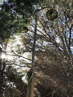
Old lights along the platform
Last Fall I posted some beautiful pictures taken by Ray Albanese of the former B&O railroad tracks
and related items located near Delaware Park. These seemingly simple photographs ended up being pretty exciting, as they resurrected the knowledge of the existence of track pans (a pretty rare item) along the line near the park. Ray also provided us with shots related to the former passenger platforms that serviced the park from the 1930's until the early 1970's. He also promised us that once the foliage retreated for the season he'd get back out there and take some more pictures. Well, he has delivered.

Ray recently sent me another batch of railroad-themed pictures from the Delaware Park area, and I think they are just as interesting as the first. In true fashion around here, they also raised another mystery. And if that weren't enough, in an email he managed to bring up a whole 'nother set of questions. But first, to the photos...

These shots can be neatly divided into two groups, the first of which shows remnants from the passenger platform used by riders of the Baltimore & Ohio Railroad for almost 40 years. It was (and remains of it are) on the north side of the racetrack, between the track and the Kirkwood Lot. The picture above and the two below show the lights that once lit the platform, as well as some of the rolling gates. Ray says there are about six of these light poles still standing. I know it's private property, but I'm a little surprised that they are still there.

Tuesday, January 15, 2019

The Benevolent Order of the Sons and Daughters of Harrison Smith

From the Wilmington paper, February 21, 1889
This story is a little different than most here, because it doesn't really involve Mill Creek Hundred or any specific site elsewhere. It's the story of an investigation I joined in at the request of someone a half a country away, but which may have helped uncover a forgotten piece of African-American Delaware history. Like many great adventures, it all began with a book.

One day out of the blue I received an email from a former attorney and current antiquarian bookseller in Texas named Adam Schachter. The owner of Langdon Manor Books in Houston, Adam contacted me hoping for some assistance with a 19th Century ledger he had acquired. It had belonged to a group called the Benevolent Order of the Sons and Daughters of Harrison Smith (hereafter called, "the group"), and mostly covered the years from 1871-1874. Never heard of them? Neither had I. The only reason Adam found me was that one of the few clues available was that the group had connections to an Ebenezer Church. He found my post about the Ebenezer Methodist Church on Polly Drummond Hill Road, but we both quickly realized it was not the same one. I initially searched, but could not find another Ebenezer Church that fit the criteria.

Although I didn't have access to the whole book, I was told that it specifically mentioned New Castle County, and possibly St. Georges. The only other thing Adam had found at that point was a reference to the group being incorporated by the state in 1889. This is what the article above is detailing. Mr. Maull (Charles H. Maull of Lewes) introduced the bill, and the group was named for Harrison Smith, "a well-known colored man". It was an African-American group organized for the purpose of caring for the sick of their community and burying their dead. Many groups like this from all communities popped up in the later half of the 19th Century, in the days before both health and life insurance were common.

Friday, January 4, 2019

The Peoples Farm

Peoples House and Barn (courtesy Dick Joyce)
Considering the number of years I've been at this and the relatively small size of Mill Creek Hundred, you'd be forgiven for thinking that I would have had time to get to just about every corner of the hundred by now. It turns out that there are still areas with deep histories that I've yet to delve into. One such area was brought to my attention a while back by an email from a gentleman named Dick Joyce, who lived there for much of his younger years. (It'd be impolite for me to reveal his age, but let's just say that at the time much of the country Liked Ike.) The area in question lies along Graves Road just west of Newport Gap Pike. In the 19th Century, there were three distinct properties lying along the road, all within a half mile or so of the turnpike. All three farms are long gone, of course, but two houses still remain, both of which date back well into the 18th Century.

We'll take a look at all three properties eventually, but we'll start with the one that sat closest to Newport Gap Pike -- the Peoples farm. No, this wasn't some sort of Hippie commune (not that there's anything wrong with that). It was owned for over 150 years by the Peoples family, from 1854 until 1995. The main part of the former farm is now occupied by the neighborhood of Wyndom. Although of course the history of the land goes back further than 1854, we'll start with the Peoples family, since I know there are folks around who still remember them.

Their introduction into the story of Mill Creek Hundred took place on April 10, 1854, when William Peoples (1811-1868) purchased a little more than 64 acres of land from William Strode (we'll get back to Strode in a bit). William Peoples was born in Ireland, the son of Hugh and Mary Peoples. Although his father later resided (and died) in Tyler County, (West) Virginia, since several other of his siblings lived in Delaware I would assume the family came here first. At some point prior to 1838, William met and married Mary Ann Morrison. The couple lived in Wilmington, eventually increasing their family to include six children. The 1850 Census listed William as a carter, which meant that he drove a cart (two-wheeled as opposed to a four-wheeled wagon).