Pages

Tuesday, December 28, 2010

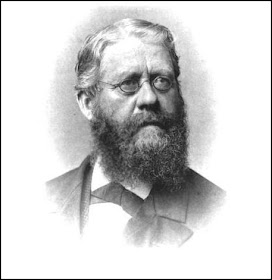
Reverend William McKennan

Headstone of Rev. McKennan, Red Clay Creek Church

Being right in the middle of the holiday season, it seems appropriate to do a post now about a religious figure, so I've picked the one whose name is probably most familiar to area residents -- Reverend William McKennan. He was mentioned before in the post about the McKennan-Klair House, which he occupied for over forty years, but now we'll look a bit closer at one of the most influential and long-tenured men to ever preach in Mill Creek Hundred.

William McKennan was born in 1719 in the north of Ireland of Scotch-Irish descent, much like many of his future congregants. When exactly he emigrated to America seems to be in question. Some sources cite 1730, but I'm inclined to think 1750 is more likely, since there seems to be no record of him here before then. Actually, there doesn't seem to be much information about his early life at all, until he became a Presbyterian minister sometime before May 1752. The Presbyterian Synod of Philadelphia it seems had taken responsibility for supplying pastors for churches in what must have then been frontier regions in Virginia and North Carolina, and Rev. McKennan was one of the ministers sent. He spent much of 1752 in the Shenandoah Mountain region of Virginia, near Staunton. In the spring of 1755, he spent three months in North Carolina.

Tuesday, December 21, 2010

Old Stone Hotel, Stanton

The Old Stone Hotel, then the residence and office
of  Dr. Irvin and Ruth Carroll
With the network of roads, turnpikes, and waterways present in Mill Creek Hundred, it's not surprising that there were a number of inns, taverns, and hotels that operated here throughout the 18th and 19th centuries. They were usually located either along a major route for travellers in the midst of their journey, or at a destination for those who had reached the end of their trek. One place, though, fit the bill for both -- Stanton. Therefore, it makes sense that there was a hotel located here, in what was the first, and at one point the largest, community in the hundred.

Stanton, originally known by the indelicate name of Cuckoldstown (the speculation as to why will have to wait for another day), sits right near the confluence of the Red Clay and White Clay Creeks, and was the site of one of the earliest mills in the area. More mills soon followed, with commerce spurred on by the fact that in Colonial and early Federal times, White Clay Creek was navigable all the way to Stanton, allowing ships to be loaded and sail straight out to Wilmington and Philadelphia. Because of this, Limestone Road soon became busy, as this route was easier for Lancaster County farmers to get their grain to market than going overland to Philadelphia. When farmers came to ship and/or have their grain ground, they needed a place to sleep before heading back home. In addition to this, Stanton also lay on the main route from Newport (and Wilmington and New Castle) to Christiana (and Newark and beyond). Therefore the hotel in Stanton also catered to weary long-distance travellers as well.

Tuesday, December 14, 2010

Reynolds-Lindell House and Property, Part II


Milk Bottle from Locust Grove Farm
 In the last post, we traced the history of the house and property located in what is now the Village of Lindell on Milltown Road, from Andrew Reynolds' building of the house in 1790 and the mill in 1799, through the ownerships of Samuel Anthony and Abraham Cannon, and finally to its purchase by Robert T. Lynam. I don't have the exact date of Lynam's purchase of the property, but we can narrow it down to sometime between 1877 (when the mill was still owned by Cannon) and 1881 (when a map shows Lynam as the owner). Lynam had acquired the property across the road (which would eventually be sold to the state by his grandson for the building of Dickinson High School) in 1848, and may have purchased Cannon's farm with his son Robinson in mind.

Unlike the other owners of the tract, the Lynams had no interest in milling, and as Scharf states, Robert Thomas Lynam tore down the old Reynolds mill in 1887. Very interestingly, according to an interview with later owner Raymond Lindell, the frame addition to the house (later used as a store for the dairy) was also built in 1887. Although I have no evidence for it, it's very tempting to speculate that some of the lumber from the mill might have been reused in the construction of the rear addition. No sources even state whether the mill was frame or stone, but if it was frame, it would not be unusual for the time for building materials to have been recycled from an older structure to a newer one. I think it is very possible that some of the wood used in the frame section of the house was actually part of Andrew Reynolds' 1799 mill.

Friday, December 10, 2010

Reynolds-Lindell House and Property, Part I

I'd be willing to bet that there are few private properties in Mill Creek Hundred that go back as far, and had such a 20th Century impact, as the land around the Reynolds-Lindell House, located in what is now the Village of Lindell on Milltown Road. From its 18th Century beginnings as a milling property, to its 20th Century role as a working dairy farm still remembered by area residents, the land was in constant use for over 200 years. Now, the only reminder of its past is the old house, today nestled in a quiet neighborhood bearing the name of its last working (and current) owners.

The identity of the first owners of the land is not clear (although it might have been the Lynams), but by the late 1700's the property was owned by Andrew Reynolds. Presumably it was he who built the main section of the two-story, plastered stone house in 1790. Scharf relates that Reynolds erected his grist mill in 1799, so either there was an earlier mill that it replaced, or the property initially was exclusively a farm. As for Reynolds himself, he was born in 1767 and through his mother, Ann Caldwell, was a member of the prominent Caldwell family of Kent County. (He was a cousin of Andrew Gray, as their mothers were sisters.) Like many other members of his family, he was active in public life, serving in the Delaware legislature for over 20 years. He also served as a turnpike company commissioner, a commissioner for the St. James school, and as one of the original three school commissioners for Mill Creek Hundred in 1817. He is still listed as owning the mill in 1832 (when he was 65), and probably sold it not too long afterwards.

Wednesday, December 8, 2010

Thomas Worrell Family and Mill


Worrell Woolen Mill and House
It's kind of funny sometimes when I go to write a post, how much variation there can be in the amount of information I'm able to find about different topics. Sometimes there's so much that it's difficult to pare it down to a blog post sized amount; sometimes there's not much, but enough to tell the story well enough; and sometimes, like with this one, I really wish I could find out more, but it just doesn't seem to be there (at least, not yet). Thomas Worrell (or sometimes incorrectly, Worrall) was a name that I neither knew nor was looking for, before it popped out at me while doing research on another topic. I had remembered seeing the name on the Beers map (although it actually looks to be "T. Werrall" on the map), but I didn't know anything about him or his family, and didn't remember seeing the name come up anywhere else. The only thing I did know was that across from his home along Mill Creek, there was a woolen mill. Now, after finding a little bit here and there, I wish I did know more about the Worrell family.

Friday, December 3, 2010

Mt. Pleasant and Union Schools

Mt. Pleasant School, 1933
As of the 1860's there were about 13 public school districts with school houses in Mill Creek Hundred. To the best of my knowledge, the Harmony School House on Limestone Road is the only 19th century school still standing intact.* For the other dozen schools, there is generally frustratingly little information that I've been able to find so far. Since even with my penchant for verbosity it would be hard to pad most of them out to a full post, I'll once in a while take a look at a couple of them at a time. In this post, I'll focus on the Mt. Pleasant School (District 34) and the Union School (District 31). For these two, at least, I've been able to scrape together a little bit of information.

Tuesday, November 30, 2010

Fell Spice Mill


Fell Spice Mill, 1873
So far on this site, we've looked at a number of different types of mills -- grist mills, saw mills, woolen mills, and iron mills, just to name a few. But there is one type that we haven't seen yet, and for a very good reason. Not only was it unique in the Red Clay Valley or Mill Creek Hundred, it was the only one of its kind in the entire state! The Fell Spice Mill at Faulkland (Faulkland Road and Red Clay Creek) was, for a time, a very successful enterprise, but one that was ultimately doomed by a series of misfortunes.

This is one of those posts where it's challenging to even figure out where to start, because there's probably enough history in the Faulkland area for about a half dozen posts or more. The location originally was the site of Oliver Evans' (who deserves a whole book to himself) innovative grist mill, then was owned by William Foulk (who lent his name to the area). Foulk sold the property to the Fells, who operated the world-renowned spice mill for most of the 19th century. Under the Fells, who were quite an interesting family in their own right and were closely entwined with the neighboring Brandywine Springs enterprises, Faulkland grew to be a small community, one that is now listed on the National Register as the Fells Lane Historic District. Even within the district, there are several houses that would be worthy of their own posts. This time, though, we'll focus on the centerpiece of the milling community, the Spice Mill itself.

Tuesday, November 23, 2010

Stanton Friends Meeting House


Stanton Friends Meeting House, 1936
To anyone at all familiar with the history of New Castle County, it should come as no surprise that there are several Friends (Quaker) Meeting Houses in Mill Creek Hundred. And to anyone familiar with the area today, it should be no surprise that they are not as influential or as (proportionally) attended as they once were. Of the three meeting houses in the hundred, the one that best reflects this change in demographics is the Stanton Meeting House. And not to give away the ending, but it's also the only one of the three that is no longer a functioning meeting house. However, we are fortunate that the building is still here, even if it's obscured enough that I'm sure very few people driving by have any idea when and why it was built.

What would become the Stanton Meeting can trace its lineage back to 1772, when the Wilmington Monthly Meeting granted locals' request, and allowed them to hold an "indulged meeting" (one for worship only -- no business is conducted, and it is under the supervision of a monthly meeting). However, at first this meeting was not conducted in Stanton, but at Hannah Lewden's house in Christiana. Very quickly, though, the meetings began alternating between the Lewden's house and a location in Stanton. I can't find anything that states definitively where these first meetings were held in Stanton, but a very good guess would be the home of Daniel Byrnes, who moved to the area the same year. Byrnes, who resided in what's now known as the Hale-Byrnes House just south of Stanton, was at the time studying to become a Quaker minister, and would become one in 1784.

Friday, November 19, 2010

Thomas Justis House

Thomas Justis House
As I do these posts, the thing that continues to amaze me is how each site, no matter how routine it seems like it will be, ends up having its own interesting and unique story. (I also like it when they perfectly illustrate a point I've already made, but more on that in a moment.) This was the case again once I started digging into (not literally -- don't worry) the Thomas Justis House, located on Milltown Road next to St. John the Beloved Church. I had always known the house was there (it's right on a main road, not hidden away like some), but I had assumed it was just another old house, without much of a story to it. Why I continue to think things like that, I have no idea.

Thursday, November 18, 2010

Mendenhall House and Mills

Mendenhall House (center) and Mills, c1895
 With all the swiftly-flowing streams within (and on) its boundaries, it's no wonder that Mill Creek Hundred has seen so many mills built along its waterways over the last 300+ years. Unfortunately, though, as manufacturing technology progressed during the Industrial Revolution, steam, and then electric power slowly marched water power towards inevitable obsolescence. By the end of the 19th Century, there were few if any water-powered mills still in operation. Some, like the Kiamensi Woolen Mills, did convert to the newer power sources for a time, but the increasing scale of manufacturing meant that the days of these cozy, secluded millseats were most certainly numbered.

After operations ceased at these mills, unless they were repurposed like Caleb Harlan's old mill, there was usually no reason to keep them around. They were generally either torn down more or less immediately so the building material could be reused, or they were abandoned and left to fall down on their own. Very often, by the early-to-mid 20th Century all that was left was the nearby miller's house and maybe a few foundations. This was exactly the case for the Mendenhall House and mills along Mill Creek, at the intersection of Mill Creek Road and (go figure) Mendenhall Mill Road. In this case, we're lucky enough that we happen to have some photographs of the area while (or shortly after) it was in operation, and the mill remained long enough to be photo'd and studied long after it's mothballing.

Monday, November 15, 2010

The Early 19th Century Rebuilding of Mill Creek Hundred


Log House common in 18th Century MCH
 It's possible that if you've read a few of the posts on this site, specifically those pertaining to historic houses,  you've noticed a trend or theme regarding the age and construction of many of these homes. In particular, you may have noticed that a number of these houses, (A) were built roughly between 1800 and 1825, and (B) were stone or brick structures that replaced (or expanded) earlier log or frame ones. If you did notice this (and even if you didn't, it's OK, you can say you did. I won't tell), it wasn't your imagination -- this was a real trend at the time in this area.

Sunday, November 7, 2010

Robert Kirkwood -- Revolutionary War Hero

Delaware Regiment at the Battle of Long Island
As far as the topics of these posts go, most times I'll plan them out beforehand and then go research them. Once in a while, though, something will pop up in a bit of serendipity and I'll know that it has to be my next subject. Such was the case with this one. After finishing the Judge Morris Estate posts, and completely unrelated to them, I happened to come across something whose timing left me no choice but to write up this post. As a result, around this somber anniversary, we'll take a look at arguably Mill Creek Hundred's greatest and most decorated war hero, Robert Kirkwood [if you know of a challenger for the title, let me know]. He's one native son whose story really should be as well known as his name.

Tuesday, November 2, 2010

Judge Morris Estate -- Part 2

In the last post, we followed the history of what is now known as the Judge Morris Estate up through the ownership of Thomas Montgomery. I haven't determined exactly when Montgomery sold the house (or if he even owned the current, existing house), but he did pass away in late 1799. According to this DNREC news release, the 2-1/2 story section of the house was built in 1792 by John Barclay, about whom I can find very little information. In 1808, the property was purchased by a member of a prominent Kent County family, Andrew Gray. When the Grays moved into the estate, they named it "Chestnut Hill", and they would own the property for the next 57 years. That same news release also states that it was Gray who, in 1825, built the 1-1/2 story west wing to house a growing compliment of servants. I still think the smaller western section looks older that the larger one, but I'll defer to the state's assessment, since it is their house (more on that in a bit).

Friday, October 29, 2010

Judge Morris Estate -- Part 1

There are, as you can see on this site, many beautiful, old homes in Mill Creek Hundred, but there are very few that are open to the public. One of the few houses that is open for public view (at least sometimes) is the Judge Morris Estate, also known as the Andrew Gray House. Thanks to the loving restoration carried out earlier last century by a man whose name is very familiar to University of Delaware alums, the house is in excellent condition, especially considering that it's at least 220 years old. In addition to its architectural beauty, few other houses can boast a roster of owners whose record of public service rivals this one.

Like almost every house of its advanced age, the Morris House is comprised of several sections built by various owners over the years. There is no clear consensus on when then oldest section of the house was built, or by whom. According to Francis Cooch in Little Known History of Newark, DE and Its Environs, there are several dates inscribed on stones on different parts of the house: 1684, 1742 or 1752, and 1777. Date stones where often used to record the date of a building's erection, but where also used sometimes to commemorate important dates long after the fact. The original land grant for much of the Polly Drummond Hill (AKA Meetinghouse Hill) area was made from William Penn to William Welsh in December 1683, so if I had to guess, I'd say the 1684 date refers either to this or possibly the date of the first house (probably log) in the area. It's unlikely any part of this house was built then.

Wednesday, October 27, 2010

Delaware Iron Works at Wooddale


Alan Wood's House, built 1826
 Although there were a fair number of mills and industries along Pike Creek, Mill Creek, White Clay Creek and various smaller tributaries throughout the 18th and 19th centuries, the greatest number and widest variety of mills in the aptly-named Mill Creek Hundred were powered by the swiftly-falling waters of the Red Clay Creek. At various times, the Red Clay Valley was home to grist mills, saw mills, textile mills, paper mills, spice mills, and snuff mills, just to name a few. Along side all those were two iron rolling mills -- one at Marshallton, and the other, the focus of this post, at Wooddale.

There are a number of potential post topics revolving around Wooddale -- Alan Wood, the forgotten community of Wooddale, the mill owner's and workers houses. All of these will no doubt be covered in due time, but right now I'd like to focus on the mill and company at the heart of it all. The first use of the millseat here at the oxbow on Red Clay Creek was the Delaware Rolling Mills, built about 1813 by Edward Gilpin and John Smith. These mills, the first iron rolling and slitting mills in Delaware, were situated just off of the very newly constructed Wilmington Turnpike (now Lancaster Pike), and produced such things as barrel hoops, iron wheels, and wire rods for making nails. After about a dozen years of operation, Gilpin and Smith leased the mills to a Mr. Jones, who brought in Alan Wood to manage them. Wood's father, James, was the owner of several large and successful iron mills in the Philadelphia area. Within a few months, the Woods had taken over the lease and were running the mills on Red Clay themselves.

Friday, October 22, 2010

Forgotten Communities -- Loveville


Beers 1868 Map, with the Loveville area circled
 Whenever you're trying to tell the history or story of an area, whether it be a city, county, state, or a hundred, one of the most important aspects will always be the communities in that area. As you know, Delaware, unlike many states, is not carved up into countless towns, villages, and townships. In fact, Mill Creek Hundred does not currently contain any officially incorporated areas. Probably the closest we have to any towns now would be Hockessin and Marshallton, but in most areas residents would identify more with their neighborhood than with any nearby community. This, of course, was not always the case. Through the years, Mill Creek Hundred has been home to numerous small communities. Over time, most of these communities have faded from memory, their names kept alive in some cases only by road names or vague, general area designations. Some of these have been gone so long that it's hard to remember that they were at one time real places, populated by real people.

These communities usually sprung up around crossroads or large employers (mills or factories), and were often named for prominent local residents or businesses. Unfortunately, for many of these old communities there is precious little information available -- too little for a full post. So what I'd like to do is occasionally stop and take time to look at a couple of these communities, and pass along whatever information I can find about them. As always, if you or someone you know has any more information on the topic, I'd love to hear about it.

Tuesday, October 19, 2010

Springer-Cranston House

The Springer-Cranston House today
 Tucked away just south of Marshallton on the east side of Stanton Road, close to the street but almost hidden from it, quietly sits one of the oldest houses in southern Mill Creek Hundred. The Springer-Cranston House is a perfect example of how even a smaller home can change fairly radically over time, seemingly with each new owner who takes control. Presently, the house is a four-bay, two-story fieldstone structure, facing south, with a two-story ell on the south-east end and dormers on the north-facing roof. However, this is nothing like the original core of the house dating back well over two centuries.

The first owner of what would become the Springer-Cranston House was a miller named John Reece, who also happens to have been the first owner of the millseat that would eventually be occupied by the Kiamensi Woolen Company. I have to admit another instance of "not-understanding-the-report" here, as the National Register form both states that Reece's house was a one-story, 24x18 foot structure, and talks about a second floor and stairway placement. Either I'm missing something, or perhaps it was some sort of a one and a half story with only a partial second floor. In any case, it's possible that this first incarnation was built as early as the mid 1760's, as Reece purchased the land in 1762. It was certainly up before Reece's death in 1795, though, and it originally faced Stanton Road.

Thursday, October 14, 2010

The Newport and Gap Turnpike

Gap and Newport Turnpike near Avondale, PA, 1896
Houses, schools, churches and factories are not the only man-made constructs vital to the growth of a community. There is one other piece of engineering that is crucial to every aspect of our economy, but which is often overlooked until it is in disrepair -- our roads. And while we often think of road-building and upgrading as a 20th century phenomenon, they were just as vital in the 19th century. In fact, the first two decades of the 1800's saw a flurry of road-building in the area, and for the most part, the roads put down then are still our major thoroughfares today, two hundred years later. One of the first of these new roads to be laid out was the Newport and Gap Turnpike (or, the Gap and Newport Turnpike). This road, now known as Newport-Gap Pike (Rt. 41), is still one of the major routes though Mill Creek Hundred today.

Tuesday, October 12, 2010

John McDaniel House


John McDaniel House
   A few posts back, when we took a look at the McDaniel-Peach House, I mentioned that it was one of two related, historic houses in the area. Now, we'll focus on the other house -- the John McDaniel House. Unfortunately, like its older companion, there is frustratingly little information available about this house and the family that built and occupied it. The house is included in the large, thematic National Register entry that deals with agricultural buildings in MCH, but the main focus of that report is the barns in the area, not the houses. Where a house does exist, it is included and given an architectural assessment, but usually only a very cursory historical background. For the McDaniel House, the entry runs four pages, but only one paragraph deals with the house (even then, it doesn't even give the first name of the builder, only calling it the J. McDaniel House). The rest describes the large, tri-level barn that used to sit next to the house, about where the next house over is, to the northwest. The barn was torn down about 20 years ago.

Friday, October 8, 2010

Brandywine Springs Park Advertisement

I recently had the opportunity to see something that I thought was not only very interesting, but that also does a great job of illustrating a larger point. In the course of rummaging through the impressive collection of park-related items that the Friends of Brandywine Springs (FOBS) has gathered over the years, the group's president, Mike Ciosek, came across the newspaper advertisement that you see here (you can click on the picture for a larger view). The full-page ad originally appeared in the "Resort Section" of the Philadelphia Inquirer (although at the top, it actually says "Inqurier". Nice.), on June 25, 1911. This was a time when Brandywine Springs Amusement Park was at its height, and four years before it was sold by its founder -- a sale that would begin the downward spiral that would eventually lead to its closing after the 1923 season.

Wednesday, October 6, 2010

McDaniel-Peach House


McDaniel-Peach House

Originally, this post was going to focus on the McDaniel saw and grist mills located on the northeast corner of Paper Mill and North Star Roads. However, once I started delving into the immediate area, I discovered that there are two historic houses nearby, each related in some way to the mills, and each with their own interesting stories. Eventually I'll get to all three sites, but here I'd like to start with the oldest structure of the group -- what I've dubbed the McDaniel-Peach House.

This house is a bit unusual, in that even though it is quite old and even has an interesting story attached to it, I've not been able to find any detailed description (such as a National Register form or DelDOT report) written about it. What we do know is that the McDaniel-Peach House sits a few hundred yards north of Paper Mill Road, just above Willow Creek Lane, and about half way between North Star Road and Limestone Road. The McDaniels are one of the oldest families in the area, having descended from Bryan MacDonald, who bought a tract of land near Brandywine Springs from William Penn in 1689. (The family name seems to have changed in the 1700's.) Although most of the family had left the area in the early 18th century, by at least the 1770's some of the remaining family had moved to the area west of Limestone Road.

Thursday, September 30, 2010

John Bishop House


John Bishop House
 This past weekend, I and my family had the pleasure of riding the Wilmington and Western Railroad -- something we try to do at least a couple times each year (our daughter, especially, loves the train). In addition to being a pleasant, quiet ride through the scenic Red Clay Valley, the whole trip oozes with history. You really never go more than a couple minutes without passing some historic house, the ruins of a mill, or the remnants of a mill race. To anyone who has ever taken this trip, the house to the right should look very familiar. This picturesque gem (one railroad volunteer told me this view was his screen saver) is the John Bishop House, and it sits just west of Barley Mill Road, near where the road crosses Red Clay Creek north of Wooddale.

Thursday, September 23, 2010

Marshallton's Travelling Bridge


The "New Bridge" in Marshallton, c.1905
Editor's Note of Caution: I now have very good reason to believe that much of this post is incorrect. There was a local bridge that was moved as stated, but it was almost certainly not the Marshallton span. In the near future I'll tell the correct story. The truss bridge in Marshallton was replaced with a concrete structure in 1955.

 Most of the posts here involve coming up with an idea for a topic, doing some light research, and then passing along what we've been able to learn. Once in a while, though, something of the "Wow, I didn't know that!" variety will pop up out of the blue, or in the course of other research. When something like this happens, I want to pass it along. And as I'm sure you've figured, something like this did happen to me the other day. While doing some reading, I found out that the 110 year old bridge that spanned the Red Clay Creek in Marshallton is still around -- but not in Marshallton. In fact, it has moved twice!

The bridge in question, just one in a string that have graced the site since the late 1700's, was built across the Red Clay Creek on what is now Newport Road at the base of Duncan Road right about 1900. It is what is known as a pin-connected Pratt pony truss bridge, and in its original configuration had five panels that spanned 57'6''. The postcard above shows the bridge in its Marshallton location, just a few years after it was built. For its time, it was a modern and impressive bridge, one befitting the importance of the road it carried. Although the road now seems fairly small and out of the way, in 1900 it was part of what was known as the Lincoln Highway -- the main east-west route through Mill Creek Hundred, and from Wilmington to Newark and beyond. Kirkwood Highway would not be built for four decades, and even the Marshallton Cut-Off (the section of Old Capitol Trail between Newport Road and Stanton Road that rerouted traffic around "downtown" Marshallton) was not opened until 1931.

Sunday, September 19, 2010

Henry Whiteman House


Henry Whiteman House
 Most of the time when I read a historical report, everything seems to make sense, and I have no reason to doubt its accuracy. Once in a while, though, I'll read something, maybe several times, and I just won't be able to get the facts as shown to jibe just right. Such was the case with this report about the Henry Whiteman House. In this instance, I'm not sure that it's necessarily wrong, so much as it's maybe just a bit unclear and misleading. In either case, I'll lay it all out and you can decide for yourself.

The Henry Whiteman House is a two story, stuccoed fieldstone home that sits off of Smith Mill Road, on the east side of Paper Mill Road. The property is a little over a mile north of Milford Crossroads, and right in the middle of an area dominated by the Whiteman family for most of the 19th century. The first of them to settle in the area was Jacob Whiteman, who in 1799 purchased a large tract of land from Thomas Rice. As for the rest of the history of the Whiteman houses, here is how the report (which is part of a larger report on several endangered properties) tells the story:
By 1804, Jacob constructed a log house and a frame barn on the 196-acre property. The 1816 tax assessment for the property lists the house as being constructed of stone. [...] Prior to his death in 1826, Jacob Whiteman sold 98 acres to his son Henry. According to the 1828 tax assessment, Henry Whiteman built a stone house and a frame barn on the property during his first two years of ownership. [...] When he died in 1855, Henry left the 98-acre farm to his son George. [...] At this time Henry had improved 82 of his 96 acres, increasing the value of the property to $8000.

George Whiteman occupied the farm for at least five years, but by 1864, the farm passed into the hands of George's brother, Henry. It was in this year that he in turn gave the farm to their brother Andrew Jackson Whiteman.

Tuesday, September 14, 2010

Delcastle Farm


Aerial image of farm buildings at Delcastle
It's probably safe to say that anyone who is at all familiar with Mill Creek Hundred is at least aware of the Delcastle Recreation facility and Delcastle Golf Course on McKennans Church Road. What many enjoying a game of tennis, or softball, or a relaxing day on the course there might not be aware of is that for about half of the 20th century, the land beneath their feet was worked by scores of hardened criminals. OK, maybe not that hardened, but they were incarcerated. For starting in 1915, the land now occupied by Del Rec and the adjoining golf course was owned by the Board of Trustees of the New Castle County Workhouse, also known as the Greenbank Prison.

Thursday, September 9, 2010

Arrests Made in Father Kenny House Fire

Kenny House after the Feb. 10 Fire
As was mentioned in the earlier post about Father Patrick Kenny and the Coffee Run Church, Kenny's 1812 home was destroyed in a fire on February 10, 2010. The blaze, determined to have been arson, began right at the outset of one of our major blizzards last year. Due to the conditions, by the time firefighters arrived and extinguished the flames, most of the three stories of the house and the roof were gutted. The structure was deemed to be unsafe, and although there was a stop-work order in place, property owners Harvey Hanna and Associates demolished what remained of the house on March 2. For their actions, the redevelopment firm was fined $1000 and prohibited from receiving county permits for the site for three years.

Tuesday, September 7, 2010

Friends of Brandywine Springs Weekend

Current FOBS Dig Site, the B&O Pavilion
As a timely follow-up to the last post about Brandywine Springs Amusement Park, I'd like to mention a few more things about the Friends of Brandywine Springs (FOBS). As was mentioned in the Park post, FOBS has a very nice website, complete with pictures and information about the amusement park. The group also staffs the small museum on the grounds of the Wilmington and Western Railroad. The museum contains displays relating to Brandywine Springs, including a model of the park and a collection of artifacts excavated from the park. It's an interesting visit, and I've staffed the museum myself many times. (Yes, full disclosure: I am a member of the Friends of Brandywine Springs.)

But where do those excavated artifacts come from, you ask? Good question. FOBS (with full approval from New Castle County) conducts archaeological digs at the park once a month (weather permitting) from April through December. It just so happens that the next dig will take place this coming Saturday, September 11, from 9:00 - 3:00. These digs are open to the public, and everyone is welcome to come and participate. Kids are welcome, too. All you need are a pair of gloves and your lunch. All other tools (and sodas!) will be provided. We meet in the parking lot of the park (at the corner of Newport-Gap Pike and Faulkland Road) at 9:00, then walk down to the dig site. This is real hands-on archaeological work at a real site, not just watching or a "seeded site". Over the past 15+ years, the group has dug at sites like the Entrance Archway, Ladies Pavilion, Pool Hall, Funhouse, and the Powerhouse. The current dig site is the B&O Pavilion, along the Wilmington and Western tracks near the site of the Entrance Archway.

If you can't make it out to dig, the FOBS business meetings take place on the Sunday night following the dig, at 7:00 at the Cedars Methodist Church. For anyone interested in the history of the park, or interested in joining the group, this is a great opportunity to come out and say, "Hi!". If you're reading this after the weekend of September 11-12, 2010, the FOBS website has a listing of upcoming dig and meeting dates. For the remainder of 2010, the digs will be September 11, October 9, November 13, and December 4. Meetings are held the following evening. Check the FOBS website for contact information about the group, digs or meetings, or email me here.

Brandywine Springs Amusement Park

Entrance Archway at Brandywine Springs
From its earliest days, the residents of Mill Creek Hundred have always been an industrious, hard-working bunch. And for a brief, shining time in the late 1800's and early 1900's, local residents and guests from far afield had a beautiful place to unwind and enjoy a relaxing day out -- Brandywine Springs Amusement Park.

Although the amusement park is usually dated to 1886, the history of the site on the southeast corner of Newport-Gap Pike and Faulkland Road goes back much further. The Yarnall, or Conestoga, Tavern had been in operation since the 1700's, and a large resort hotel was constructed on the site in the late 1820's. This first hotel burned to the ground in 1853, but the site was far from done. Immediately afterwards, a second hotel was created by combining three houses on the site that had been built 20 years earlier by a former hotel manager. This second hotel plugged along with limited success until 1886, when Philadelphian Richard Crook was brought in to manage it.

Friday, September 3, 2010

McKennan-Klair House

The McKennan-Klair House
Partially on a suggestion from a reader, we'll take a look now at an old house that has connections to a famous name in the area (McKennan), as well as a prominent family that I believe is getting its first mention here in this blog (the Klairs). On top of that, this home happens to be one of the oldest still standing in the area. The McKennan-Klair house sits on the north side of Limestone Road, just north of Milltown Road. It was built in two clearly-defined early phases, with a couple of 20th century additions. And although the large bank barn that once sat across the road is gone, there are a few outbuildings still extant on the property.

The land on which the house sits, like most of Mill Creek Hundred, was originally granted by William Penn. In 1706, John Ball, a blacksmith by trade,  purchased the property from the original grantee. Ball had several land holdings, and according to Scharf, operated a bloomary (a furnace for the production of iron from ore) somewhere "near St. James Church", probably on White Clay Creek. It is not known exactly when Ball erected his home, but is thought to date to the 1720's. This oldest part of the house, the left side as you're looking at it, is made of brick covered in stucco, and has two windows on each of its two stories and a centered door. There is a kitchen wing on the rear. After passing through the hands of a John Robinson (and being the subject of a court-settled land dispute), the property was purchased in 1765 by Reverend William McKennan.

Tuesday, August 31, 2010

Dr. Swithin Chandler

Dr. Swithin Chandler, M.D.
While it's true that Mill Creek Hundred doesn't boast many residents who attained a national level of fame or influence, it doesn't mean that there haven't been plenty of our sons and daughters who have been important on the state or local level. Then, as now, there have always been those special people who seem to show up everywhere and have a hand in almost every aspect of community life. One such person in the mid-to-late 19th century was Dr. Swithin Chandler, M.D.

Swithin Chandler was born in 1830, the second child of Thomas Jefferson and Sarah Yarnall Chandler. The Chandlers and Yarnalls were both prominent families in the area, and among the future doctor's many relatives were his uncle Abram, who operated the old Harlin mill at Milltown, and (I think) his mother's cousin Holton Yarnall, who operated the Yarnall Tavern at Brandywine Springs. At about age seven, Swithin went to live with his grandparents, who I assume lived nearby in Brackinville. [The 1868 Beers map shows a T.I Chandler, who I think should be T.J., and several other Chandlers, but at this point I don't know where the grandfather, also named Swithin, lived. Another investigation, another day.] His grandfather died a year or two later in 1839, but Swithin continued to live with his grandmother until he was 16. He spent the next few years after that attending school in the winter and working during the summers.

Friday, August 27, 2010

More on the Kiamensi Woolen Mill

Since publishing the post on the Kiamensi Woolen Mill a few weeks ago, I've come across a few more goodies, as well as a story about the site that I think deserves telling. Finally, I want to try to clear up a related aspect of the mill history that I think I'm a bit more clear on now.

First, the goodies! In response to the first Kiamensi post, I was contacted by Marshallton resident Denis Hehman, who was gracious enough to provide me with some documents, as well as the story I'll pass along in a moment. Denis has his own website, Historic Lower Red Clay Valley, that is well worth checking out. Among many other things, he has on there some present-day pictures of the mill site and the surrounding area. He also has a map, prepared by the State Historic Preservation Office (SHPO), showing the remnants of structures that were present when they surveyed the site a few years back. The highlight, though (at least for me), was a four page History of the Mill Seat at Kiamensi that comes complete with maps, including an amazing 1927 Sanborn Fire Insurance map. Although the map dates to a couple years after the mill closed, it is an invaluable resource that shows just how extensive the operation was at the site. The report was one of several done in the 1990's when the county was looking at replacing sewer lines throughout the Red Clay Valley. I thank Denis very much for sharing these with us.

Wednesday, August 25, 2010

New Pages on the MCH History Blog

In an ongoing effort to make the site easier to use, and to become more involved in the community, we have introduced several new pages recently here on the Mill Creek Hundred History Blog. First, there is the Index of Topics page which is an alphabetical listing of post topics covered so far. As the site grows and scrolling through old post becomes more difficult, hopefully this will make it easier to find a specific topic that one might be searching for.

Secondly, there is now a Calendar of Events page listing some history-related events and special happenings in the area. I have listed as much as I can think of that might be of interest, but if anyone knows anything else that should be included, please let us know. Some hints on how to use the calendar are included on the page.

The most recent addition is the Map of Historic Sites. It took me a little while but I was able to embed an interactive map showing the locations of sites that have been featured in posts. You can drag the map around, as well as zoom in and out. I'm hoping this might be useful to anyone who might know where a site is, but might not know what it is. A reader could also choose to read posts dealing with sites in one particular region, as well. Also, if the location of a site is ever not described very well in its post, you can always go to the map to find just where it is. Just another site navigational aid.

Finally, the About the MCH History Blog page was created to allow a longer explanation of what this is all about, and what we'd like it to be. Since one of the things we'd like it to be is a forum for discussion about our local history, there are comment boxes on every post, as well as on the "About" page. Please feel free to comment at any time and about any post, or use the "About" page comments section for general comments that might not be limited to one particular post. We welcome all comments, criticisms, and suggestions about the site. Thanks for visiting us, and we hope you continue to enjoy our site.

Tuesday, August 24, 2010

Scharf's "History of Delaware: 1609 -1888"

J. Thomas Scharf
In our continuing series of "Resources for the MCH Researcher" (also known as "Things I Use a Lot to Look Stuff Up"), we look now at probably the most commonly cited piece of Delaware history out there, J. Thomas Scharf's "History of Delaware: 1609-1888". And yes, now that this is the second one (the 1868 Beers Map being the first), I can officially refer to it as a "continuing series". To be honest, when I first decided to write this post, I was just going to say a few words about what the book is, what it's good for, what it's not, link to it, and that was about it. However, after some quick research, I've found that the author himself is worthy of some digital ink, as well as his, for the time, unique methods of conducting his research.

I had always assumed that Scharf was some stodgy old professor or historian who had assistants do his work, while he just sat back, edited a little, and stuck his name on the books. As it turns out, he was nothing of the sort. John Thomas Scharf was born in 1843 in Baltimore, MD, had a Catholic education, and went to work as a bookkeeper at his father's lumber yard at age 16. When the Civil War broke out two years later, he left Baltimore and joined the Confederate Army with an artillery battalion. He saw action in numerous battles over the next two years before being wounded in 1863. After recuperating, he decided to leave the army and join the Confederate Navy. Scharf served in the navy until early 1865, when he rejoined the army and was sent on a covert mission to Canada. The young Marylander's luck finally gave out on him, as he was captured in February 1865 and spent the rest of the war in prison. After the war, he returned to Maryland and joined the state militia, rising all the way to become the aide-de-camp to the Governor.

Friday, August 20, 2010

St. James Church

The earliest settlers in Mill Creek Hundred were a mix of Swedes who had moved inland from the settlements at Fort Christina (Wilmington) and, briefly, Fort Trinity (New Castle), and English who arrived after they took control of the area in 1664. Whether Swedish or English, the one thing all these early inhabitants had in common was their religious zeal. It seems hard to comprehend in today's rapid-transit world, but if these early Swedish Lutheran or Anglican residents wanted to worship, they had to travel either to Old Swedes Church in Wilmington, or Immanuel Church in New Castle. Not surprisingly, they started exploring options a bit closer to home.

The church that stands today at the corner of Old Capitol Trail and St. James Church Road was built in 1822, but the history of the site goes back over a century further. In a will dated 1701, Arient Jansen Vanderburg, the first European owner of the land, gave a portion of his estate to Holy Trinity (Old Swedes) Church. Sometime in the next few years, a small log chapel was built that was used both by missionaries from Old Swedes as well as Immanuel Church. In 1714, the land was conveyed to James Robinson, who set aside 10 acres (presumably where the log church was) for church use. The log chapel, now considered inadequate, was replaced in 1716 by a 32 x 22 foot wood frame church. This church, which would serve for over a century, was considered (at least by the English) to be a "chapel-of-ease" for Immanuel Church -- sort of like a "branch office" for those unable to make the trek to New Castle.

Monday, August 16, 2010

Harmony Schoolhouse

In previous posts, we have covered things like houses, mills, factories, places of worship, farms, and even a hospital. Probably the most important community building not yet covered here is the schoolhouse. In the early days of Mill Creek Hundred, schools were few and far between. There may have been a few church schools and a number of short-lived private schools (really not much more than a teacher instructing a few kids), but most education was done in the home, or not at all. In the late 18th and early 19th centuries there were a few attempts in Delaware at passing school laws, with little success. (Although one early law did lead to the incorporation in 1808 of a school near St. James Church.) Real public schools in the state didn't get started until after the passage of the "Free School Act" in 1829. [It's a rather long PDF, but here is a very good account of the history of school districts in Delaware.] This law set up school districts in the state, each with one school and at least 35 pupils. There were provisions for districts to be split or combined, and each was controlled by, and funded by, the residents of the district. By 1868, there was all or most of 12 districts in Mill Creek Hundred, with parts of four more.

Thursday, August 12, 2010

Marshallton in the 1920's, Through the Eyes of a Girl -- Part II

Marshallton Colored School, 1920
We now continue our journey [from Part I] through Marshallton of the '20s, on Duncan Road, travelling up towards Kirkwood Highway. On the right hand side where apartments are now, were a bunch of houses. This was the African American section of Marshallton. On Jackson Avenue (not far to the left) was the Marshallton Colored School, which was built in the 1920’s with funding from Pierre Samuel DuPont. Between Duncan Road and Jackson Avenue, Ham Run meanders down to empty into Red Clay Creek. One of the things the kids of Marshallton looked forward to was to pack their lunches, go to Ham Run, sit on the stones and picnic.


We have now turned around and are going up Jackson Avenue. As we get to the end of Jackson Avenue and we pass the house where Anna Mae and her husband lived, she begins into a story about Herb Thornet and his floral shop. From Jackson Avenue we make a left onto Chalet Drive. Anna Mae is telling of 6-8 large glass greenhouses filled with flowers that Mr. Thornet was growing for his floral shop. Mr. Thornet’s house is still standing at the end of Chalet Drive. As children, they would walk up to the greenhouses and go through and smell all the wonderful flowers.

Marshallton in the 1920's, Through the Eyes of a Girl -- Part I

Marshallton, about 1905
Anna Mae Hedrick is a lifelong resident of Marshallton, Delaware. She was born in January 1916, in her Grandmother’s house (which is still standing) on the corner of Old Capitol Trail and Newport Road. Anna Mae has a passion for Marshallton and many fond memories and stories to pass along. So many memories and stories in fact, that there are reports of a book being written about Anna Mae and her life in Marshallton. Because of this, I will focus more on what Marshallton was like in the 1920’s and 1930’s, through the eyes of Anna Mae. I greatly look forward to reading the book when it comes out.

We will begin our journey through Marshallton at the corner of New Street and Old Capitol Trail. There is a small brown building with a larger house next door. The small brown building was Hubert’s Grocery Store. What Anna Mae remembers most was the candy counter. The children loved going to the store and buying their penny candy. The mothers would give their lists to Mr. Hubert, who would gather the items. They would then load the groceries into their wagons and wheel them home. There were a handful of butchers in the area as well, but most of the time people would travel into Wilmington and buy their meat from Haldas. There were several grocery stores, the most noteworthy of which was the American Store. It was an early grocery store chain, and a forerunner of Acme. They began popping up in the late teens and early twenties. The original Marshallton location of the American store was on Greenbank Road in the red brick building that now houses Events Unlimited. I was told that Irwin Eastburn was the first to own and operate this location. The store was later moved to Old Capitol Trail where Big D’s Pizza place is currently.

Monday, August 9, 2010

An Extension off Old Capital Trail

In addition to doing posts about the people, places, and events of Mill Creek Hundred's history, once in a while I'd like to share some of the random little things I run across while doing "freestyle" research. Today, I found this little passage seen below:


Thursday, August 5, 2010

The John C. Vansant House

While several of the houses already written about here sit on or near major roads, many of the area's historic homes are situated off the main roads -- on smaller roads, their own little paths, or sometimes the remnants of older roads passed by in the age of the automobile. One example of the latter is the John C. Vansant House, which sits at the paved end of Possum Hollow Road just east of Milford Crossroads (the intersection of Possum Park Road and Paper Mill Road). And while this little stone and frame house didn't by itself play a particularly large role in the area's history, nor was it owned by anyone particularly important, not surprisingly for a 200 year old house it does have its own story to tell. It also has an architectural feature unique to the area.

Friday, July 30, 2010

When Carry Nation Came to Mill Creek Hundred

An area's history does not consist solely of its people, places, and buildings. There are also significant events that occur that each add their own little piece to the grand puzzle of history. Often these events, while exciting to those involved at the time, are soon forgotten by later generations. One example, the passage of the British army through the area in 1777, was touched on in the Hockessin Meeting House post (and may be returned to someday). Another such event was the two-stop visit in 1904 of the fiery temperance advocate Carry Nation. Her rallies at both ends of the hundred were attended by thousands, and were no doubt the topic of countless conversations for a long time afterward.

Carry Nation, for those who may not remember history class, was probably the fiercest and most popular temperance (anti-alcohol) advocate of the early 1900's. She first came to prominence in Kansas, where, armed with bricks and her trademark hatchet, she would go to saloons and liquor stores to destroy as much of the establishment and stock as she could. For her actions, she was both deified and vilified, as well as being arrested over 30 times between 1900 and her death in 1911. To raise money for the temperance cause and for her legal bills, she travelled the country giving speeches and selling merchandise. Once such trip brought her through Mill Creek Hundred in August 1904.

Wednesday, July 28, 2010

Hockessin Friends Meeting House

Hockessin Friends Meeting House
From the time the English took control of Delaware in the 1660's, and especially with the arrival of William Penn in 1681, it is no exaggeration to say that the most important group of people to the development of Wilmington and New Castle County was the Society of Friends, or the Quakers. Persecuted in England for their religious and pacifist beliefs, many Quakers came to settle in Penn's New World colony. With their dedication to hard work, education, and simple living, the Quakers quickly became the dominant force in the area's industry, and remained so for about 200 years.

The first Quaker Meeting House in Delaware is believed to have been the Newark Meeting, which was located near the present-day neighborhood of Carrcroft in Brandywine Hundred. By the late 17th and early 18th Centuries, Quaker meeting houses had popped up in Wilmington, New Castle, and southern Chester County. In the early 1730's, Mill Creek Hundred's growing Quaker population began to tire of travelling east to attend the Centre Meeting, and desired to hold meetings closer to home. And while private meetings were held at the home of William Cox as early as 1730, it wasn't until October, 1737 that the land was purchased for the meeting house and burial ground.