Pages

Tuesday, December 27, 2011

The Bartley-Tweed Farm

Bartley-Tweed House
Tucked away on a bend on what I always thought of as a "cut-through" road (on the back way to Newark), sits a brick house with a few surprises, and an interesting story. The house, which turns out to be quite a bit older than I thought it was, is flanked by a somewhat newer (but still historic) carriage house/granary. And until recently a barn stood across (and unnervingly close to) the road from the house, all making up what is known as the Bartley-Tweed Farm.

The house sits on the north side of Fox Den Road, a few hundred yards west of Polly Drummond Hill Road (across from the Polly Drummond Shopping Center and McGlynn's). From the construction of the earliest remaining part until the late 19th Century, the property was owned by at least 5 different families. Unfortunately, not much is known about most of the owners except for one, and he's more closely connected with another site -- even though he owned this one for almost thirty years. The property itself is notable for two reasons: 1) it was the site of several undertakings not common elsewhere in the area, and 2) in several instances some of the construction here was a bit ahead of its time.

Monday, December 19, 2011

The Cedars

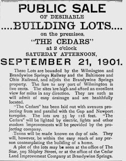
Ad promoting the sale of lots in The Cedars
If asked to describe Mill Creek Hundred today, I think the word near the top of most people's list would be "suburban". Obviously, this was not always the case, and the transition from a rural area with a few interspersed villages to full-blown suburbia had to start somewhere. For the most part, the suburbanization of MCH took place after World War II, when all those returning servicemen (and women) wanted to move out of the cities and have room to spread out to raise their generation of Baby Boomers. I happen to live in a house that was part of that first wave of post-WWII building (it was first sold in March 1947).

However, even my neighborhood was not even close to being the first planned housing development in the hundred. A full 45 years prior, streets were laid down and lots drawn up for a housing development right next to one of the busiest places in the area. This was not a coincidence, for while the post-war flight to the suburbs was made possible by the automobile, this earlier wave was enabled by that great turn of the century aid to commuting -- the trolley. The development of The Cedars, located on Newport-Gap Pike and backing up to Brandywine Springs Park, was an example (though not a prototypical one) of what was called a trolley (or streetcar) suburb.

Wednesday, December 14, 2011

R. R. Banks: MCH's Automotive Pioneer


Richard R. Banks' Wilmington Automobile Company
 As we've seen in numerous previous posts, there has been a wide range of different industries active at one time or another in Mill Creek Hundred. One industry I'm willing to bet that you haven't associated with the area is the automotive industry (although, to be fair there are/were/will be auto plants in two neighboring hundreds). No, I'm not going to tell you that there was once an automotive plant in MCH, but there is a local connection to the early days of the automotive age. It seems there is good evidence that the first automobile to be built in Delaware was constructed right here in MCH. And the men involved were pioneers in the field, at a time when many thought the car was just a passing fad.

Tuesday, December 6, 2011

The Stanton and Brandywine Springs Schools

Stanton School, 1926
By the mid to late 19th Century, Mill Creek Hundred contained all or part of at least 17 separate school districts. Each district contained one school, and at least 13 of those schools were situated within the boundaries of the hundred. We've already looked at a few of them (Harmony, Fairview, Mt. Pleasant and Union), and even at a few of the teachers. As the 20th Century progressed, these old districts and schools were eventually consolidated into larger ones, and many of the schoolhouses lost. In this post, we'll focus on two more of these schools, each representing old districts -- the Stanton School (District #38) and the Brandywine Springs School (District #33). Both of these today have "descendant" schools still in operation, and one of these old schools (although not the first one at the site) is still serving its community, albeit in another capacity.

The District #38 school in Stanton was undoubtedly one of the longest-serving schools in our area. It was your classic one-room schoolhouse, made of stone, and measuring about 30x27 feet. It had two outhouses (which sometimes needed to be emptied, as this 1886 report shows), and stood on the north side of Main Street, west of Limestone Road, about halfway between the Friends Meeting House and Telegraph Road (about where the Goodeals is now). Exactly when it was built is a bit of a mystery. The number "38" does appear on the 1849 Rea & Price map (although, oddly, there is no "S.H." as there is by the other school houses), so it was surely built by then. Scharf claims that it was the first public school in Mill Creek Hundred, which would probably put its erection sometime around 1829, when the first real public school act in the state was passed. Writing in 1888, to Scharf it was already the "old stone school-house".

Tuesday, November 29, 2011

The David Eastburn Farm

David Eastburn House
Author's note: This was the original post about the David Eastburn farm. For a much more detailed history of the property itself, a follow-up post can be found here.

It's been a while since we've focused directly on the Eastburn family (although it's hard to stay more than two or three steps away from them), so we'll now return to northern Mill Creek Hundred and take a look at a farm anchored by a mid-19th Century home, but with elements a good deal older than that. I started thinking about this property while revisiting the Josiah Hulett House recently. While there are not too many examples in the area of the mid-century architectural styles that featured square-shaped houses, the David Eastburn house is a good one. Located on the northeast side of Corner Ketch Road, partway between Paper Mill Road and Doe Run Road, the farm dates back to the time when the Eastburns were the preeminent family in the area.

Although there are older structures extant on the property, the Italianate Style (as best as I can determine) house was built in the mid 1850's by David Jeanes Eastburn (1811-1899), probably at the time of his marriage in 1857. David was the seventh child (of fourteen!) of David and Elizabeth Jeanes Eastburn. The elder David was, along with brother-in-law Abel Jeanes, the co-founder of the Eastburn-Jeanes Lime Kiln business. After the younger David's father died when he was only 13, he, like most of his siblings, stayed in the area to help run the family business and farm the surrounding land.

Friday, November 25, 2011

The Stanton Hotel

The Stanton Hotel, c. 1900
A while back, we looked at the hotel that, during its time, was usually looked upon as the "main" hotel in Stanton -- The Riseing Sun. And while it was likely the site of the first hotel/tavern/inn in Stanton, it was not the only one in town. Across the street from the Riseing Sun, operating for almost 100 years, was another hotel, whose memory -- and whose very name -- has almost been lost to history. Whereas there's been a decent bit written about the Riseing Sun, the Stanton Hotel has been nearly forgotten. To be honest, I wasn't really able to find to much more than some basic facts, and a long list of probable proprietors.

The hotel (or much more likely, hotels) sat on the northeast corner of Limestone Road and Main Street in Stanton, next to where the palm reader is now. I believe it was probably centered right about where the sign is in the grass on the corner. Although this fact is only ever alluded to as far as I can tell, it seems as if there were two different structures that served as the hotel over the years, and only vague references as to when the old one was razed and the new one built. It's not even clear who actually owned the property. And to make things even more confusing, for much of its history the hotel seems to have been operated by a long list of different proprietors. Seriously -- everywhere I look, there is a different list of operators, with almost no overlap of names.

Thursday, November 17, 2011

Josiah G. Hulett's House -- Found

Josiah Hulett's old house, 1939
Over the summer, I did a post about Josiah G. Hulett which included information about a house that he and his family resided in for about ten or fifteen years. Thanks to Josiah's great-granddaughter, Jeanne Jackson Dell’Acqua, we knew a little about the house, but not everything. Jeanne was fairly sure that the house stood somewhere near (or most likely, on) the Hercules property off of Lancaster Pike and Hercules Road, but we didn't know for sure exactly what its location was. Now, we do. It was exactly where I thought it was -- I just couldn't find any proof until now.

The picture above is a close-up of an aerial photo taken in 1939 by the Dallin Aerial Survey Company, many of whose pictures can be found on the Hagley Museum website. Luckily for us, probably due to its connection with the DuPont Company, the site includes several pictures of the Hercules property dating to the late 1930's. Luckily, again, the pictures are of a fairly high resolution, which allows you to zoom in pretty tight. To refresh your memory, the picture below was the one of the house provided by Jeanne, and taken about 1920.

Tuesday, November 15, 2011

Brandywine Springs Video

Over on DelawareOnline, there is a nice little video piece focusing on the Brandywine Springs Amusement Park. You can find the video here. The two men featured in the video, Mark Lawlor and Mike Ciosek, are without a doubt the two foremost experts on the park and its history. Lawlor is the author of the book Brandywine Springs Amusement Park: Echoes of the Past 1886-1923, which is the only comprehensive work on the history of the park (and an invaluable resource). In the early 1990's, spurred on by his research, Lawlor co-founded the Friends of Brandywine Springs with Mike Ciosek, who has served as its president for nearly 20 years. (Mike has also served, among other things, as the lead in all the archaeological digs at the park, and certainly knows more about how it was built than anyone else alive.)

I happen to know a good deal about the park myself, so if you have any questions about anything mentioned in the video (which can also be found after the jump), or about any of the wonderful pictures used, feel free to ask. Other than that, enjoy!

Thursday, November 10, 2011

The Curtis Paper Mill -- The Curtis Years


Curtis Paper Mill, 1880
 In the last post, we took a look at the early years of the paper mill on White Clay Creek just east of Newark, and followed it from its beginnings around 1789 to the departure of the Meeteer family in 1843. However, only those well-steeped in local lore are likely to know the site as Meeteer's Mill, or the Milford Paper Mill. That's because even though the mill seems to have been all but falling down in 1848, after the brief ownership of Joseph Perry, the site was far from finished. In fact, under the name of the new owners, the Curtis family, the site would continue to manufacture high-quality paper for almost another 150 years.

It's not known what drew Solomon Minot and George B. Curtis to Delaware, but the brothers from Newton Lower Falls, Massachusetts must have seen the potential in the old Meeteer mill. If anyone could, it would be them. Minot (as he was known) and George were two of nine Curtis brothers in the papermaking business, all following their father. When they arrived, the brothers borrowed $7500 from their new Newark neighbors to purchase the mill at a sheriff's sale and almost completely rebuild it. The only salvageable pieces were the waterwheel and the papermaking machine. The following year, they borrowed another $3067 from a Philadelphia firm to install a more advanced papermaking machine. The brothers obviously knew their business, because within 10 years they had repaid their entire debt, an occasion they celebrated by throwing a dinner for their former creditors at the Washington House Hotel in Newark (later the site of the Stone Balloon, where I'm sure at least a few readers have also "celebrated", and now the Washington House Condos ).

Sunday, November 6, 2011

The Curtis Paper Mill -- The Meeteer Years


Curtis Paper Mill, c.1915
Way back, in one of the first posts on this site, we looked at the Meeteer House on Kirkwood Highway, just east of Newark. Now, we'll focus on the source of the Meeteer's wealth, briefly mentioned in the earlier post -- their paper mill. First built during the early years of our nation, rebuilt twice and upgraded numerous times over the years, high-quality paper was produced at this site almost continuously for over two hundred years. When production finally ceased here in 1997, the Curtis mill was the oldest operating paper mill in the country -- and that was the one built halfway through the site's history!

Although the final years of the mill are well-documented and remembered, the details of its beginnings are a bit hazier. What we do know is that in 1789, Thomas Meeteer of Birmingham Township, PA purchased land on the east and north sides of White Clay Creek from Samuel Painter, Jr. Though there are no direct references to a paper mill being present then, the deed does apparently reference "Edward Meter's mill dam". What Edward's relationship to Thomas was and kind of a mill he had are unclear.*[Update below] Assuming there was not one there already, Thomas Meeteer likely erected his paper mill very soon after acquiring the site, although the first known reference to it wasn't until 1798.

Saturday, October 29, 2011

Ambrose Reed

Ambrose Reed
In reading this site or through research of your own, you've no doubt realized that the history (and for the most part, the present) of Mill Creek Hundred is, not to put too fine a point on it, rather white. That's not to say that there were no non-white residents in the hundred, however. For example, in 1800 there were 85 free blacks and 82 slaves (for comparison, there were 2,027 white residents), and in 1840 there were 311 free blacks and 43 slaves (2,789 white). After the Civil War and the passing of the Thirteenth Amendment, there continued to be free black residents in the hundred, mostly working as hired farm labor, although some did own their own properties. And while it's difficult to find much information on most of the area's black residents, there is one man we do know a little about, although not as much as I had hoped.

In his excellent 1976 book Hockessin: A Pictorial History, author Joseph Lake briefly mentions the story of Ambrose Reed in the chapter dealing with the kaolin clay mining industry in the region. When I saw the name in the book, I remembered having been asked about him by a commenter earlier this year, and I recalled having found some information about Reed. I also remembered that some of the information didn't seem to line up exactly right. As it so happened, things only got more confusing as I dug further.

Monday, October 24, 2011

The Robinson-Highfield House

Once in a while, we get really lucky and we'll have a great deal of information about a particular site -- who built it and when, who lived there, and a nice pile of background information about the residents. This ain't one of those sites. The Robinson-Highfield House (AFART note below), located on the northwest corner of Lancaster Pike and Loveville Road, has several very frustrating holes and ambiguities in its story. Instead of continuing to bang my head against this particular wall, I'll just lay out what I have been able to figure out about it, as well as what I haven't. And while we do know a good bit about this property, this is one of those instances where I'll have to accept that this is just a starting point for investigation into the house and its owners, and not a comprehensive history.

The first of the mysteries surrounding the Robinson-Highfield House is also the most basic -- When was it built? A 1999 DelDOT survey, which included information from earlier work in the area, states that the house was constructed in about 1850. While this is very possible, there are a couple of things that call this into question, although none of them are anything close to definitive. The first is that New Castle County Land Use records list the construction date of the house as 1820. I know that these records are notoriously inaccurate (as far as I know, they just list what someone tells them), but it makes me wonder if the owners have a specific reason for putting the date that early.

Friday, October 14, 2011

Origins of the Name "Kiamensi"

This won't be a particularly long post, but I figured I'd address the subject now, since Bill Harris' recent comment got me thinking about it. There have already been two separate sites featured on this blog that contain the name "Kiamensi" -- the Kiamensi Woolen Mill and the Kiamensi Spring Water Company. On top of that, Kiamensi was adopted as the name of the community that sprung up around the woolen mill, as well as the B&O Railroad depot nearby. And of course, it survives today as the name of the road that goes through the area, and in the name of several neighborhoods. But where did this sometimes tricky to spell and pronounce word come from?

If you said, "From the Indians," you'd be right. It does in fact derive from a Native American word, one of the few still to be found in Mill Creek Hundred ("Hockessin" being another). However, like much associated with the region's first inhabitants, some of the details are not quite clear, and there is some overly-romanticized myth thrown in for good measure.

Wednesday, October 12, 2011

The Kiamensi Spring Water Company


Kiamensi Spring Water Bottling Plant, 1908
One of the most heavily mocked (at least, by me) business models of the past few decades was bottled water. Only in late 20th Century America, so I thought, could a company expect people to pay good money for something they can get almost free at home. As it turns out though, bottled water is now a nearly $10 billion industry in the US alone (although sales have sagged a bit the last few years). It also turns out that it was far from a new idea -- our area was ahead of the curve by almost a century. In 1907, a new company was formed -- The Kiamensi Spring Water Company -- and began shipping its product from its source on the east bank of Red Clay Creek.

As one might expect, there are, in the vicinity of Brandywine Springs Park, quite a few natural springs. One, a chalybeate spring, was the impetus for a resort hotel, and later, an amusement park. Most of the springs in the area, though, are clear, clean, and fresh (or at least, they were a century ago). In 1907, while the amusement park was at the height of its popularity, several of its officers (including owner Richard Crook and VP L. Heisler Ball (in between stints as US Senator from Delaware)) decided to capitalize on one of these clear springs and market its waters directly to consumers. Considering the rather questionable state of municipal water supplies at the time, in conjunction with a public newly-aware of the dangers of germs and contamination, bottled spring water and beverages made from it were hot sellers.

Thursday, October 6, 2011

The Adventurous Hettie Dickey

Sometimes I think we develop this picture of Victorians as being very staid, never-step-out-of-line, do-what-they're-told kind of people, especially Victorian women (the occasional Lizzie Borden notwithstanding). And while that certainly was not always the case, it probably was more often than not, which is what makes a story like Hettie Dickey's newsworthy at the time, whereas now she would just be that weird cousin that no one wants to talk about.

The first time I ran across Hettie Dickey was this newspaper article from 1895, which details the young Stanton woman's trek halfway across the country to Chicago earlier in the year. You can read the article in its entirety, but I'll try to briefly summarize it here. In the early afternoon of March 24, the 26 year old Hettie donned her brother's suit (which she had stowed away in the woodshed), and walked from her house in Stanton towards the B&O station at Kiamensi. From there, she walked westward along the tracks, then across some fields until she arrived in Newark. In Newark, she boarded a train to Baltimore, then another to Chicago.

Thursday, September 29, 2011

Rea and Price 1849 Map

I recently ran across something on the interwebs that was just too cool not to pass along -- at least in my own odd sense of the word "cool". A while back, I did a post about the 1868 Beers map, which is probably the historical map I use the most in my research. Besides the fact that it's a very fine map (and colorful, too!), one of the reasons I use it so much is the simple fact that I have all of it in one place. For all the other maps, I only had various bits and pieces of them culled from different places -- some totalling more or less the entire area, some with gaps. Now, however, I've found a full version of my second favorite map, the 1849 Rea and Price map.

I don't know when they put it up, but sometime recently the New Castle Community History and Archaeology Program  (NC-CHAP) posted a full-sized, high resolution, zoomable version of the map. You can find this version here. To be honest, since even the best copies I had seen of the map were in black and white, I didn't even know that the original was in color. It's actually a beautiful map, in its own way.

Tuesday, September 27, 2011

Samuel Dennison House


The Samuel Dennison House in 1986
A lot of the historic houses and locations of Mill Creek Hundred featured on this site lately have been in quiet, secluded, out-of-the-way places. That doesn't mean that all of them are, of course, and Limestone Road, being one of the oldest roads in the area, has more than a few old homes still lining its path north to the farmland of Pennsylvania. Several of these sites have already been featured, like the Harmony School, the Mermaid Tavern, the Aquilla Derrickson House, and the McKennan-Klair House. This time, we'll take a look at a house a slight bit younger than these, but still no youngster at 135 years old -- the Samuel Dennison House.

The Dennison House is located just north of Papermill Road, about 130 feet back from the west side of Limestone Road (it once sat closer to the road, until Limestone Rd. was widened and realigned in 1964). It's a 2 1/2 story, five-bay house built of local fieldstone, although it is plastered everywhere except the front. It was built in the "Georgian I" style, with one large room on either side of a central stairhall. An ell protrudes from the north half of the rear of the house, and was probably built at or about the same time as the house, which was erected in the centennial year of 1876. The builder of the house, Samuel Dennison, was by no means a newcomer to the property. In fact, he and his family had lived there for more than 50 years before he upgraded to his big, new, stone home.

Thursday, September 22, 2011

New Castle County Bus Map


Circa 1940 Bus Route Map (photo by Mike Ciosek)
 You know how sometimes when you're not even thinking about a problem and BAM!, out of nowhere, a flash of inspiration comes to you? That's what happened to me a week or two ago when I (belatedly) realized I might have a resource to answer some questions raised by a few previous posts. This goes back again to the discussion about trolley and bus service in Mill Creek Hundred, triggered by the picture on this post, which then spawned this one. The resource I finally thought of dates to the time just after tracked trolley service ended, but while trolley coaches (or trackless trolleys) still plied the roads along with  gasoline buses. What it is specifically is a map showing the routes of those services in New Castle County.

The large, wall-mounted map (probably about 4ft x 5ft) is located in the back video room at the Red Clay Valley Visitor's Center, at the Wilmington & Western Railroad's Greenbank Station. The map, while not exactly hidden, is not in a position where it is viewed by most who visit the museum. It's also somewhat unique in the collection in that it's one of the few bus-related items. That being said, I think it's a fascinating piece, and one that I've spent quite a bit of time just staring at.

Tuesday, September 20, 2011

The Lost Village of Roaringtown?

From frequent contributor of helpful, interesting, and sometimes frustrating information Donna Peters, comes this excerpt from the April 12, 1753 edition of The Pennsylvania Gazette:
    BY virtue of his majestywrit of venditioni exponas to me directed, on Saturday, the 28th inst. will be sold, by publick vendue, at Roaringtown, in Mill creek hundred, New Castle county, A tract of land, containing upwards of 300 acres, divided into 2 plantations; each plantation has valuable improvements, and is situated on the publick road which leads from Conestogo to Newport, and White clay creek landings, being convenient for either store or tavern, and is but 4 miles distant from divers places of Divine Worship (or from said landing) and lies commodious to sundry merchant mills, is in a very healthy part of the country, well water, and has many other good conveniences. Also on said day will be sold, A house and lot of ground, containing one acre, near White clay creek landing; the whole being the property of Walter Thetford; taken in execution at the suit of sundry creditors, and to be sold at ten a clock on said day, as per conditions to be exhibited, by GEORGE MONRO, Sheriff.
There are a few things I can make a bit more clear from this public notice (I'll get to those in a moment), but rising far above all those is this: Roaringtown? Over the past few years, I've read a fair amount about the history of Mill Creek Hundred and of Delaware in general -- not as much as some, but more than most. In all that I've read, I can honestly say I've never seen so much as a passing mention to a "Roaringtown". Has anyone else? I can't even think of anything remotely close that this could be an alternate spelling for. Is it possible that this is some sort of lost community of the mid-18th Century, whose name all but vanished from the historical record? I did a cursory search for the name, and the only Roaringtown that comes up was an old village in Cumberland County, PA, just north of Harrisburg. Nothing else.

Friday, September 16, 2011

Another Blaze at the Fr. Kenny Farm

I would be remiss if I didn't call attention to this story from last weekend, in case anyone missed it. In what is now becoming a disturbing pattern, there was yet another fire at the abandoned Mundy Farm, also known as the Rev. Patrick Kenny Farm. This time, the fire was located in the large, stone barn that looms over the site where Fr. Kenny's house once stood. The historic 1812 house was destroyed in a fire on February 10, 2010. That blaze was determined to have been arson, and in September 2010, two teenage boys were convicted of setting the fire.

This most recent fire occurred last Sunday, September 11, as many of the firefighters were preparing for a memorial service at the Delcastle Recreation Area in remembrance of the 343 firefighters lost in the 9/11 attacks. The fire was extinguished in about a half an hour, but did "significant damage" to the structure. The barn, the original part of which was constructed by Rev. Kenny soon after he took up residence in his new home and which was expanded several times over the years, was thankfully still standing after the ordeal. The only question is, for how long?

It's been well documented that the owners of the property would like to develop the site, and now with the house gone and the barn heavily damaged, I wouldn't put much money on the long-term survivability of the site. Thankfully, the adjacent cemetery and site of the first Coffee Run Mission is a separate parcel, still owned by the Catholic Church. Again, to me, this is another reminder that these historic structures we have are not guaranteed to always be here, and that we need to study and appreciate them while we can.


Update 10/13/2011:

The News Journal is reporting today that "Two Hockessin-area boys, ages 15 and 16, have been charged with arson and conspiracy in a Sept. 11 fire that burned a

Wednesday, September 14, 2011

Samuel P. Dixon House


Samuel P. Dixon House, 1986
 Sitting very close to Barley Mill Road, just south of Brackenville Road, is what was, until recently, a simple, four-bay fieldstone house. Along with a large stone barn and a springhouse, it represents yet another relic from what was once one of the most prominent families in the northeastern part of Mill Creek Hundred -- the Dixons. Along with the Dixon-Jackson House and the Dixon-Wilson House (both in Hockessin), the Samuel P. Dixon House dates from the time when the descendants of Irishman William Dixon owned large tracts of land in the area.

Although from the front (not including the new large addition on the far side, not shown in the picture above) the house looks like one uniform structure, it was actually built in two stages, probably in succeeding generations. The original section (the left half in the picture above) was built about 1791, and was a two-bay, single room plan common among Quakers of the time. Several decades later, likely by the son of the original builder, the western addition was added, effectively doubling the size of the house.

Tuesday, September 6, 2011

The Trolley Comes to Stanton

Since the picture at the right seems to have generated a good bit of interest, I thought I'd share a few quick notes on the trolley shown travelling down Main Street (today's Route 4). This image is one of only two I know of showing the trolley in Stanton (if I ever find the other one again, I'll post it). There were, at one time, three different trolley lines serving various parts of Mill Creek Hundred. Two were somewhat related, but we'll focus here on the third, and southernmost, line in the hundred.

The first two trolley lines to be run into MCH -- the West Chester, Kennett and Wilmington (AKA, the Kennett Trolley) and the Peoples Trolley -- were both created more or less from scratch to serve the Brandywine Springs Amusement Park. The third line, which just barely made it into the southeastern portion of the hundred, can trace its lineage back to the early 1890's, when the Wilmington City Railway Co. built a new route that included part of Maryland Avenue. At first it went only as far as Linden St. (where I-95 now passes overhead), but within a year it was extended to Beech, and then as far as 6th Ave. It wasn't until 10 years later, in 1901, that the line would be extended out of the city.

Friday, September 2, 2011

Historical Floodings of the Red Clay and White Clay


Flooding in Marshallton, 1938 -- courtesy LRCV Blog
 After seeing Red Clay Creek jump its banks yet again last weekend, this time thanks to Hurricane Irene*, I thought I'd take this opportunity to highlight a few other instances from the historical record of flooding in the area. It certainly seems like there have been quite a few major floods in the past dozen years or so, but flooding in the Red Clay Valley is not anything new. There may be more of them now, but living and working along the creek has always been a risky proposition. This post is by no means a comprehensive list, just a few examples I could find documentation for.

* -- The Lower Red Clay Valley blog has some great pictures and videos of the August 27-28 flooding in Marshallton. You can find them here and here.

The first one took place on January 25-26, 1839, and was one of the most violent floods seen in the area at the time. This article in a Baltimore newspaper a week later gives some of the details. The Brandywine seems to have been the hardest hit by the freshet, no doubt fueled by heavy rain and melting snow. Among other damage in Wilmington, the first covered bridge over the Brandywine on North Market Street, built only a few years prior, was washed away. Of more interest to us, though, is the mention, however brief, of flooding along the Red and White Clay Creeks. More specifically, it makes mention of two railroad bridges affected by the raging waters. At first this had me a bit confused, but then after looking at some old maps, I think I know what the article is referring to.

Wednesday, August 31, 2011

New MCH Nostalgia Page

This is something I had been thinking of doing for quite some time, but now the time seems right. Spurred on by a few recent comments and some fascinating emails, I've decided to launch the MCH Nostalgia Forum. It's a stand-alone page on the blog here (accessible from the tabs above), designed to be an outlet for stories and memories of a more recent nature than are usually covered on the blog. Here is what I put as a lead-in to the page (because yes, I am that lazy):

Tuesday, August 30, 2011

White Clay Creek Presbyterian Church


White Clay Creek Presbyterian Church
 In the early days of Mill Creek Hundred, two religious groups played major roles in the development of the area -- the English Quakers and the predominantly Scotch-Irish Presbyterians. By the early 1720's, the latter group had established two bases of worship in the hundred -- Red Clay Creek Church in the east and White Clay in the west. Since I've been slowly posting pictures of headstones from the White Clay Creek cemetery, I thought it was a good time to look at this 300 year old congregation, currently in its fourth church and second location.

White Clay Creek Presbyterian Church sits on the north side of Kirkwood Highway, at the base of Polly Drummond Hill Road. Before it was known as Polly Drummond Hill, though, the high ground to the north was called Meeting House Hill. The meeting house for which it was named was not where the present church is, but about a mile up the road, on Old Coach Road (actually, it's on an old section of the road now called Coach Hill Drive). As early as 1708, residents near White Clay Creek petitioned the Presbytery to be allowed to set up their own meeting house, but the New Castle church objected, not wanting their congregation to be split.

Friday, August 19, 2011

The First Name of the First Town in MCH


Main Street in Stanton, courtesy Ken Copeland
 There are, of course, countless unknowns and mysteries surrounding many aspects of the history of Mill Creek Hundred. There are plenty of names, dates, and places that are either lost to time, or frustratingly unclear in the historical record. One of these mysteries though, in my mind stands out above the rest. It dates back to the very beginnings of MCH, and has been frustrating historians for at least 120-some years, and I would imagine probably a good bit longer than that. It has to do with the early history of the first community established in what would become Mill Creek Hundred -- Stanton. More specifically, it has to do with the origins of the odd-sounding name by which Stanton was known before it was renamed "Stanton".

It is well-documented in the historical record (and recently brought up by a commenter on another post) that in the 18th Century, the village near the confluence of the Red Clay and White Clay Creeks was known as "Cuckoldstown". Not surprisingly, this indelicate moniker has raised quite a few questions over the years, but no answers -- until now. After a surprisingly brief bit of research, I believe I have finally figured out where the name came from, and in the process discovered another surprising fact -- Cuckoldstown was not the village's original name. Now, after at least two and a quarter centuries, we can finally restore to MCH's first town, its first name.

Wednesday, August 17, 2011

George A. Wolf -- Publisher and Artist


George A. Wolf postcard of the old Marshallton Mill
 I think anyone who does historical research would agree that one of the most enjoyable experiences associated with the task is when you run across a connection or a fact that makes you sit back and say, "Wow, I did not see that coming!" I had just such an experience recently while doing what I figured would be some quick, mostly fruitless research. It dealt with a man who wasn't born in, nor did he live in, Mill Creek Hundred, yet some of what we know of the area a century ago is because of him. He's probably not well-known to most these days, however some detail-oriented people who enjoy old pictures and postcards may be somewhat familiar with the name of George A. Wolf. His name is on many of the picture postcards of Wilmington and the surrounding area that date from the first decade of the 20th Century.

Because his name appears on many of the pictures I've seen of Wilmington and vicinity (especially Brandywine Springs Amusement Park, where he was the "official" publisher of postcards), I had always assumed that George A. Wolf was a photographer. The more I started to uncover, however, the more I realized that this was not the case. The key was the postcards, not necessarily the photographs on them. It turns out, Wolf was actually a publisher in Wilmington. "Publisher", though, doesn't quite cover all of it. He was also more of what I'd call a graphic artist, a fact we'll return to shortly.

Monday, August 15, 2011

The Stanton "Covered" Bridge


The Stanton "Covered" Bridge
 It's understandable if the title of this post may be a bit confusing in a couple of different ways. First, you might be saying, "I've never heard of a covered bridge in Stanton." Secondly, you might be asking, "What's the deal with the quotes around "covered"?" As it so happens, both of these items are connected, and they led me on a journey to what I think is a very interesting lost bit of local history. Then, as a bonus, the answers I found helped me make sense of another picture that had kind of bugged me for a while now. And in the process, I was exposed to a type of structure that I didn't even know existed, let alone existed right here in our area.

Thursday, August 11, 2011

The William Morgan Farm


The 1813 William Morgan House
 About two hundred yards north of Corner Ketch, straddling Doe Run Road, sits a beautiful matching set of a house and barn. The pair of two-century-old fieldstone structures (and a slightly newer frame one) make up the William Morgan Farm, and they're just another example of the quiet history sitting all around us here in Mill Creek Hundred.

The story begins, not surprisingly, with William Morgan, who purchased 235 acres of land north of Corner Ketch in 1797. The National Register of Historic Places (to which it was added in 1987 as part of a group of MCH sites) nomination form states that Morgan bought the land from an agent of the Penn family, although it seems a bit late for that to me. In any case, I've not been able to find very much definitive information about William Morgan. He probably came from Pennsylvania, since later on his daughter is listed as having been born there in 1777. There is a William Morgan, Revolutionary War veteran, buried in the Pencader Cemetery in Glasgow, but I don't know if this is the same person (the death date of 1833 is about right).

Tuesday, August 9, 2011

Wilmington & Western's Summerfest 2011

If anyone happens to be in the area this coming Saturday, August 13, 2011, and is looking for something fun to do, the Wilmington & Western Railroad will be having its now-annual Summerfest. In addition to three trains running that day (all pulled by one of the WWRR's steam locomotives), there will be a number of other events and attractions taking place at the Greenbank Station on Newport Gap Pike, just down the hill from Kirkwood Highway.

Trains will depart from Greenbank at 10:30, 12:30, and 2:30, all headed for the Mt. Cuba Picnic Grove on the banks of the Red Clay Creek. After a half-hour layover at the picnic grove, the train will return to the station where there will be lots going on. For those of you who like to eat, there will be food available provided by Backyard Louie's BBQ, and ice cream from Woodside Farm Creamery. There will also be magicians and musicians roaming around, as well as facepainting for the kids.

But don't worry, us grown-ups won't be left out of the cool stuff, either. Stanley Steamers will be on display, courtesy of the Marshall Steam Museum at Auburn Heights. There will also be displays from the American Helicopter Museum in West Chester, and antique fire equipment from Cranston Heights Fire Company. Plus, and this is in no way meant to be an "attraction", I'll be there working in the Historic Red Clay Valley Visitor's Center and Museum, located in the old W&W Yorklyn Station next to the main station. It should be a fun day, and with any luck we'll have some nice weather. So if you're interested, stop on by this Saturday!

Thursday, August 4, 2011

The P W & B's Stanton Station

There are three main railroad lines that, historically, have serviced Mill Creek Hundred (or at least, close to it). All three are still in service today, although in different forms. The Wilmington & Western (now a tourist line) and the Baltimore & Ohio (currently the CSX freight line) are the relative newcomers to the area, having been built in the 1870's and 1880s. Decades before that, though, some of the first tracks in the state were laid just south of MCH (and technically, through a small part of it). This track, constructed in 1836-37, is now the Amtrak line that winds south from Claymont, through Wilmington, past Newport, Stanton, and Newark, and on through to Maryland. Thanks to a wonderful picture forwarded to me by local resident Ken Copeland, we have, to the best of my knowledge, the first glimpse of one of the local stations serving that line in the 1800's. I had known where the station was, but I had never seen a picture of it before.

To give just a quick backstory, the railroad that ran just south of White Clay Creek was known during the 19th Century as the Philadelphia, Wilmington & Baltimore Railroad (PW&B). It was formed in the early 1830's, originally consisting of four companies with connecting lines reaching from Philadelphia to Baltimore. The Delaware portion of the line was called the Wilmington and Susquehanna, but by early 1838 the separate companies had merged to form the PW&B. It's first president, Matthew Newkirk, was also the owner of the Brandywine Chalybeate Springs Hotel. He may even have bought the resort with the hope that his railroad would increase business, although it didn't really seem to.

Tuesday, August 2, 2011

Josiah G. Hulett


Josiah G. Hulett
 This is another one of those posts that I originally had no intention of writing, but I eventually was given and came across so much information -- and interesting information -- that now I feel I have to. This is very much related to the post about the Bailey family, and most of the information for it came from Jeanne Jackson Dell'Acqua, a descendant of both families (Josiah is her great-grandfather). She's been researching her ancestry for almost 30 years, and has found quite a bit of fascinating information, much of which directly relates to the history of Mill Creek Hundred. She's been kind enough to share her findings with us, and through them, will allow us here to get to know a little about a very interesting 19th Century resident of the hundred, Josiah G. Hulett.

Josiah Garrett Hulett was born on April 9, 1839 to William Hulett (1790-1850) and Martha Bailey Hulett (1805-1877). Martha was the sister of John and James Bailey, and the daughter of Amor Bailey. Although it's hard to pin down the exact location, census records hint that William Hulett's farm may have been on Yorklyn road, not far east of the Hockessin Friends Meeting House. William and Martha had five children before William's death in 1850. After his death, Martha was unable to keep the farm, having only small children. As many do, she turned to her family for help. The Huletts went then to live with Martha's brothers, the Baileys. They split between the brothers, and Josiah ended up with James Bailey. (Although to be fair, they were on neighboring farms, so the family wasn't actually very "split up". The arrangement was probably just more practical from a living space standpoint.)

Wednesday, July 27, 2011

What's the "Hundred" in Mill Creek Hundred?

A couple weeks ago I was talking to a friend who lives out of state, and he asked me what seems like it should be a fairly simple question: "What does "Hundred" mean, in "Mill Creek Hundred"? For those of us who have lived for an extended time in Delaware (especially New Castle County), we're probably used to hearing "Mill Creek Hundred", or "Brandywine Hundred", but we may not think much about where the term comes from. I've actually sidestepped this post for this long because there really isn't a good, simple answer to the question. Or, there is a simple answer, but it's not good enough. Or, there's several good answers, but none of them are exactly right ... but none of them are completely wrong. Sometimes, thinking too hard about a word only serves to confuse things. But, I've come this far, and never let it be said that I'm not willing to try to confuse things even more.

We'll start with what should be the simple answer to the question of "What is a Hundred?" -- It's an old English political unit, smaller than a county or shire. Even this, though, is not quite exactly accurate. Besides England, equivalents to hundreds have been used in parts of Finland, Norway, Sweden, Denmark, Germany, and Australia. Their use in England dates back to at least the 900's, but were probably in use long before that. The ultimate origin of the term may date back almost 2000 years to Teutonic armies, and their custom of dividing their armies into groups of 100 men from a given area. When Teutonic tribes invaded England in the 5th and 6th Centuries, the division of land and the invader's settling patterns may have been influenced by these "hundreds" of warriors.

Thursday, July 21, 2011

The Bailey Family

Samuel A. Bailey
Sometimes the most enjoyable research is the stuff that comes out of the blue, and ends up somewhere you never thought it would go. A few days ago, commenter M.S. left a few stories and a few questions over on the Forum, so I decided to take what I thought would be a quick look and give a quick answer. The innocent question that sent me off involved an old woman named "Miz Bailey", who the commenter's brother remembered as living in an old house in the woods near Hercules Road and Newport Gap Pike. I figured that if I was lucky, I might be able to find her in a census and uncover her full name. I didn't expect, however, to be digging back over 200 years, and clearing up a few questions about some old maps along the way.

To get right to the answer to the question first, "Miz Bailey" was in fact Margaret Mabel Bailey, who died unmarried in 1953. The house in which she lived her entire life, and which never had electricity, was located a few hundred yards east of Newport Gap Pike, and south of Hercules Road. I can't be sure exactly what house she was residing in, but it's likely that it was one that had been in her family for well over 100 years by the time of her death. The Bailey family's history in Mill Creek Hundred goes back even further, at least three generations prior to Mabel and 150 years before her passing.

Monday, July 18, 2011

Early History of the Mendenhall House

I feel I need to apologize in advance for the possibility that this post will read as being a bit disjointed and rushed. Frankly, I need to just write it before I get too frustrated and give up. When I write a post, I generally like to answer more questions than I raise, but sometimes it doesn't work out that way. This is one of those times. Two previous posts (here and here) have looked at the Mendenhall family and their holdings along Mill Creek, but since the writing of the recent post, new information has been presented to me regarding the house overlooking the Mendenhall Mill/Mill Creek Road intersection. There are tantalizing clues as to the early history of the house, but unfortunately few concrete answers. What I'll do here is present what we know, what we believe to be true, and the questions that have yet to be answered. My hope is that someone else out there may have the key to unlocking this mystery.

Thursday, July 14, 2011

Mendenhall House and Mill Revisited -- Additions and Corrections


James Mendenhall's 1826 Mill
A while back, I did a post about the Mendenhall House and Mill located around the intersection of Mill Creek Road and Mendenhall Mill Road. While I still think that most of what is in the post is correct, and it was all written with the best information I had at the time, I have come across new information that sheds new light on the early history of the area, and a little on the later history. One of the reasons I started writing this blog originally was to document my own journey of exploration through the history of the Mill Creek Hundred area. And like many journeys, this one sometimes heads the wrong way. I want to use this post to clear up some of the things that I now know I got wrong, and to add some more information to the story.

The first place to start, I guess, is at the beginning of the Mendenhall story, and to state that I now know that it wasn't really the beginning. In the previous post, I had written that Aaron Mendenhall, Jr. (1729-1813) moved to Delaware about 1763, and settled first on a property known as Sugar Loaf Farm near Brandywine Springs. Then, about 20 years later, his son James A. Mendenhall (1763-1839) moved to the Mill Creek area and erected the first mill there. With the new information that I've found and was refocused to (thanks, Walt C.), I can now see that almost none of that is accurate. Contrary to what my wife thinks, I actually can admit when I'm wrong.

Sunday, July 10, 2011

Paper Mill and Faulkland Road Covered Bridges


Postcard showing the Paper Mill Covered Bridge
 I don't think it would shock anyone if I said that Mill Creek Hundred is chock full of creeks, streams, runs, and all manner of moving water (c'mon, "Creek" is right there in the name). And while these were certainly a blessing for millers and manufacturers, they sometimes got in the way when you were trying to get from one place to another. Very early in our history, there were no bridges on what passed for roads in the area -- you just forded the streams at a shallow spot. Later, bridges did begin to be built, but they were usually small, wooden, and in need of frequent maintenance and repair. In the early part of the 19th Century, a new type of bridge began to appear, one that would last longer and require less maintenance than earlier ones -- the covered bridge. At one time, MCH was dotted with at least a dozen or more covered bridges. Here, we'll look at two of them -- one of the longest, and probably the shortest.

The first bridge we'll look at was one of the last in the county to be intentionally taken out of service, and was to my eyes one of the most beautiful -- the Paper Mill Bridge east of Newark. The history of this bridge, not surprisingly, is closely tied to the nearby Meeteer (later, Curtis) Paper Mill. When the mill began operations in the late 1700's, there was no bridge here -- only a nearby ford, called Tyson's Ford. In 1817, the first bridge carrying what we now call Paper Mill Road over White Clay Creek was built. The cost was $1771.83 for the wooden, non-covered bridge. This bridge sufficed for the next 44 years, until it was replaced in 1861 by a 96 ft. Town lattice truss covered bridge ("Town lattice truss" was the style of bridge, the most common, especially in rural areas, since it could be built without metal fasteners).

Wednesday, July 6, 2011

Eastburn Store

Isaac Eastburn (1806-1890)
In this blog, we've looked at a variety of different sites from life in Mill Creek Hundred in the 18th, 19th, and early 20th Centuries. We've seen houses, mills, hotels, churches, and even a resort and amusement park. There's one important community building of the time that we've yet to focus on, though, mostly because precious little survives of these outposts. I don't know if it comes from watching too many Little House on the Prairie episodes with my daughter and wondering how Mr. Oleson gets all his supplies and who he sells them to, but I've been interested recently in the small general stores that once served rural residents like those in MCH. Now, thanks to prompting from a question from a reader and local resident (thanks, Robin S), we'll take a quick look at one of those stores, owned by a member of a very prominent local family -- the Eastburns. As with most things, it seems, we don't have a complete picture of what went on, but we do have enough to get a general idea.

Just south of Corner Ketch, and north of the Paper Mill Road/Polly Drummond Hill Road intersection, there's a small little stub of a street called Pigeon Hollow Road. There are only about three or four houses on the street, but two of them are survivors from the era when the Eastburns controlled the region. There is a two-story stone house, with a large, newer addition on the rear; next to it is a longer, 1 1/2 story frame house. This second house, for much of the second half of the 1800's, was the site of the Eastburn Store (I don't know that that was what it was called, but that's how I'll refer to it).

Thursday, June 30, 2011

The Dixon-Wilson House

I think it's been a while since we've been in the Hockessin area, so I thought we'd take a quick look at one of Mill Creek Hundred's historic houses hiding in Hockessin (also, it seems to be Alliteration Day). Sitting on the north side of Valley Road, about half way between Limestone Road and Lancaster Pike, is the Dixon-Wilson House, one of the oldest in the area. Sometimes, I think, people tend to think of Hockessin as a bit of a newer area, relatively speaking. There is some truth to this, since Hockessin as an organized town didn't really take off until later in the 19th Century, well behind such earlier centers as Stanton, Marshallton, Milltown, or Brackenville. It got its economic steam from the kaolin mining industry, and has even been likened to a western boom town in the late 1800's. However, the roots of settlement in the area go back much further, back to the beginnings of English occupation of what would be Mill Creek Hundred.

One of the original families to settle in the Hockessin area was the Dixons, who purchased a large tract from the Penns around 1730. The family consisted of a widow, and her four sons. One of the sons, Henry, built a home along what's now Lancaster Pike. His brother, John Dixon (1702-1740), received a portion of the homestead a bit farther west, and built his own home on Valley Road. Although it appears to have been added to extensively over the years, Dixon's house still stands. It's quite possible that the inscription on the datestone -- "I & J Dixon - 1732" -- reflects the construction date of the earliest section. The "I" in the inscription refers to John's son Isaac, to whom the house went after John Dixon's untimely death.

Monday, June 27, 2011

Fell Spice Bottle

Prompted by the recent comment on the Fell Spice Mill post by a descendant of several workers at the mill, blog reader and occasional information-provider Donna Peters decided to do a little electronic digging, and she came up with a few things that I thought were rather interesting. I don't think I have too much to say about them, but I'll share them with everyone here.

The first, and to me, the most interesting, is the bottle shown on the right. It is a full, unopened bottle of "Borneo Ginger" from CJ Fell and Bros. I've seen empty Fell's bottles online a few times, but I had never seen a full one before. I'm not sure if there's any way to be certain that the contents of this bottle were ground at the mill at Faulkland, but I assume that that's the likely scenario. If so, there's even a chance that they were processed by Leonard, George, or James Woodward, the ancestors of the commenter. For what it's worth, according to "The Grocer's Encyclopedia" from 1911, "Borneo Ginger" was just a trade name for some white ginger, none of which was actually from Borneo. Below are a few other views of the Fell ginger bottle.

Wednesday, June 22, 2011

A New Page on the Blog -- Cemetery Pics

As some of you may have noticed, a new page went up on the Mill Creek Hundred History Blog yesterday (I think that's what they call a "soft opening".) It's something that I've been wanting to do (or at least start) for quite a while now -- cemetery pictures. Here's what I wrote as a quick intro on the page:
One of the greatest resources we have for researching history and genealogy, or just for feeling a tangible link to the past, is cemeteries. Here in Mill Creek Hundred, we're fortunate to have several cemeteries that contain burials dating back to the 1700's, and which hold the final resting places of a large portion of the hundred's 18th and 19th Century residents. This page contains links to photos of many of their headstones. This is by no means a comprehensive catalog, and will be a work in progress for quite some time. If you have any corrections or additions to this collection, feel free to chime in on the Forum or email me directly.

Monday, June 20, 2011

Biographical and Genealogical History of the State of Delaware, Volume 1

I realized that it's been a while since I've done a post highlighting one of the resources I regularly use in my own research for this site. I while back, I wrote a bit about Scharf's 1888 History of Delaware, but now I'd like to look at a slightly different work, from about the same time. The Biographical and Genealogical History of the State of Delaware was published in 1899 by J.M. Runk & Co. of Chambersburg, PA. Much like Scharf's work, Runk's can be an invaluable resource -- so long as you only take it for what it is. And thanks to Google, part of it is now free and online.

Runk's is somewhat of an odd work, but useful in its oddness. It was published in two volumes, totalling around 1,400 pages. Volume 1, which is the one currently available for free through Google Books, starts off with an almost 80 page general history of the state, most focusing on the early period of settlement and colonization. After that, it goes on for about another 100 pages with brief biographies of some of the prominent men and families of the state. Following those begins the real meat of the work -- its "Biographical and Genealogical Sketches".

Friday, June 17, 2011

Yellow Hall


Thomas Rankin, Jr.'s Yellow Hall
 Interestingly, there are at least two examples in Mill Creek Hundred of historic houses sitting today in the middle of golf courses. And since it seems like we haven't visited the western reaches of MCH for a while, I thought we'd take a look at one of these, a home sitting between the fairways of the Deerfield Golf Club (or Louviers, for you older DuPonters). The house in question was known as Yellow Hall, and I believe it is the only remaining historical link in the area to the Rankin family, once a highly-regarded clan in western MCH and northern White Clay Creek Hundred. But, due to emigration from the area and a phenomenon I have yet to see to this degree in any other local family, the Rankins more or less faded away by the early 20th Century (although I'm sure there are a few around linked to this part of the family).

The first of his family to settle in our area was Joseph Rankin (1704-1764), a Scots-Irish emigre who came to the New World with his family about 1721, originally settling in Chester County. Ten years later, he purchased 150 acres in White Clay Creek Hundred, near the Head of Christiana (Rt. 273, near the MD line). Joseph was one of the first settlers in that area, and was one of the founders of the Head of Christiana Presbyterian Church, where he and many of his family would later be buried. On his farm northwest of Newark, Joseph Rankin raised at least eight children we know about -- seven boys and one girl. The daughter never married, and three of his sons moved to North Carolina. Two more of the sons remained in Delaware, but I believe moved out of the area. Only two of the boys -- Thomas and Joseph, Jr. (who we'll return to in a moment) -- remained to have an impact on the local area.