 |
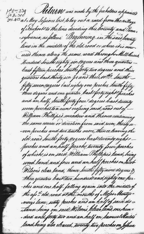
| Page 1 of the 1804 Road Survey |
As noted in several previous posts, the first few decades of the 19th Century were busy time of road building in the early Republic. The tumultuous years of the fight for independence and the somewhat chaotic period of sorting out the new country and its war-ravaged finances was drawing to a close. The country was growing, and so was its economy. With more people and merchandise on the move, everyone realized that the existing road system at the time was inadequate for the new nation. New thoroughfares needed to be constructed, whether by blazing new trails or improving old roads, many of which were no more than mildly glorified cow paths.
Then, as now, there were two different ways to go about funding something as ambitious as building a new road -- publicly or privately. In New Castle County, the task of publicly funding things like roads and bridges was given to the Levy Court. The newly-developed method of private funding for roads was the turnpike company, a corporation licensed by the state to build a road and allowed to collect tolls to pay for the maintenance of the road. As we've seen,
the way history played out the Gap and Newport Turnpike Company was incorporated in 1808 in the State of Delaware, to extend southward a planned road leading from Gap, PA to the DE-PA state line. This is what we now call (in Delaware) Newport Gap Pike.
However, 210 years ago there was another plan floating around, prior to the forming of the turnpike company. And while it's obviously important to know what
actually occurred in the past, it's also fun to think about the what ifs. The could have beens. The almosts. And to try to think how this alternate history would have differed from our own. In this case we're contemplating a road that never was, and thanks to the work of Walt Chiquoine, we can see exactly where this road would have been.


