Pages

Friday, December 15, 2023

The Springer-Chandler Farm

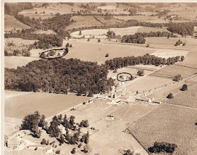
The Springer-Chandler farms, 1927
For this story we venture again outside the confines of Mill Creek Hundred, but not by much. In fact, 
the land in question was originally part of a tract that extended into MCH, and ultimately ended up as part of one which was featured in a post not long ago. It's a story that is, on the one hand, fairly simple. Over the course of more than 300 years, it was really only owned by members of four (although, really three) different families. But on the other hand, there are a few details and actions that make the chain of ownership a lot more complicated and confusing when viewed on a closer level. Also, there are actually several tracts in question, which multiple times are split up, only to be later reunited in ownership. Also also, I don't have a strong understanding of the exact boundaries of most of the tracts. 

"Originally", the land in question (which is along Lancaster Pike between Centerville Road and Red Clay Creek) seems to have been on the eastern end of the holdings of the Barker family, who began acquiring much of the area around what would become Wooddale from the Penns as early as the 1680's. There were several members of several generations of Barkers who bought a number of tracts over the years, from Wooddale up to Mt. Cuba. For our purposes here, suffice it to say that in 1764, several grandchildren of Samuel Barker (who had purchased the land in 1685 from William Penn) sold a 200 acre tract in western Christiana Hundred to Charles Springer, son of Jacob Springer. While the exact boundaries are unclear to me (lots of white oaks and hickories and other property lines I don't know), it seems to generally sit now between Lancaster Pike and Barley Mill Road, mostly (or entirely) west of Centerville Road.

Charles presumably settled on the land and lived there for almost 40 years. In his 1802 will, he divided his land between sons Reese (who got the westerly part) and Thomas (who got the rest). Apart from being severed from the other Barker holdings, this is the first of several instances of the property being split up, only to be later reunited. Thomas Springer died in 1824, and in his will gave most of his land to his son Charles, except for about 40 acres that he says he bought from Joseph Robinson in 1809. This portion went to son William Foulk Springer. I was frustrated at first because I could not find any record of that 1809 sale, but I think I finally have a theory as to what happened. 

Monday, November 13, 2023

The Travelling Newport-Gap Pike and Mt. Cuba Bridge

The Newport-Gap Pike bridge
in its original location, 1921
I have to admit that this post is a follow-up that took way, way too long to come about. Like, kids are in middle school now who weren't even born when I wrote the original part of this story. Back in September 2010, I did a post entitled "Marshallton's Travelling Bridge", which I later realized was not completely accurate. In that post I stated that the bridge installed over Red Clay Creek in Marshallton (Newport/Duncan Road) in about 1900 was moved in 1925 to another location across Red Clay Creek. Then, 45 years later, it was moved yet again to the site where it remains to this day.

To be fair, much of that post is correct, with two glaring exceptions -- I had the wrong bridge and an incorrect first move date. I think I realized that fairly early on, but I never got around to actually giving the correct information. However, very recently a commenter (thank you, Larry Davis!) asked about a story he had heard in his younger days, about how the Newport-Gap Pike bridge over Red Clay Creek at Greenbank had been repurposed somewhere else. That immediately rang a bell with me, and here we are. Yes, Larry, you were right.

It turns out that it was not the Marshallton bridge that has travelled around -- it's the Newport-Gap Pike bridge. They are very similar bridges, both being Pratt Pony Truss bridges. The Pratt Truss design was invented in 1844 and was one of the more common designs in the late 19th and early 20th Centuries, both for railroad and roadway bridges. The "Pony" designation indicates that the trusses are not connected at the top. I haven't been able to determine when this particular bridge was built, but I did find an 1884 newspaper article about New Castle County bridges that did indicate that there was an iron truss bridge in place at that time. It's quite possible that this is the same bridge.

Monday, October 9, 2023

The Abners Woodward House

The Abner Woodward House 
A little while back there was a post about the Stephen Mitchell House, located on North Star Road, in the community of the same name. Toward the end of that post, we learned that the farm associated with the house was sold as part of a larger tract by Ellen du Pont Wheelwright in 1952. She sold it to a group of Dupont Company employees working at the new, nearby Louviers site, who were providing convenient housing opportunities for themselves and their co-workers. However, while the Mitchell, or North Star, Farm was the largest portion of the newly-created community of North Star, it was not the only part.

On the west side of North Star Road, Mrs. Wheelwright had another property she called Barnstable Farm. Its farmhouse is located along North Star Road, and for 121 years it was owned by three generations of the Woodward family. The house itself may have been built by the first Woodward there, or it may have already been standing when he arrived in 1808 -- that's yet to be determined. However, the history of the farm definitely goes back further than that.

Unfortunately though, much of that earlier history has thus far eluded me. I know that in April 1798, James Short sold a 129 acre plantation to John Heron, "late from the County of Donagall in old Ireland". Frustratingly, the only document I can find is actually the mortgage from Short to Heron, not the actual sale. This means it's written as if Heron is transferring the land to Short (which he would if he doesn't pay the debt), so while it does have a detailed description of the metes and bounds (which are too confusing for me to map out), it does not have any information on how or when Short came into possession of the land (only that Short, "of Mill Creek Hundred", sold to Heron dated the same day).

Friday, September 8, 2023

Weedon's Foray Historical Marker

The Weedon's Foray Historical Marker
This past July (2023), an exciting historical event took place in Mill Creek Hundred. Nestled down in the Mill Creek valley, off of Stoney Batter Road down at the bottom of the hill, a brand new historical sign was unveiled! It memorializes an event from the days of our country's founding, and the marker was largely the result of one man's tireless work (no, not me). The event is known as Weedon's Foray, and it was (until recently) a largely forgotten event that really does deserve more recognition.

Weedon's Foray was a small skirmish that took place between two other, more well-known engagements, but which did end up having an importance of its own. The date was September 8, 1777, and just 5 days earlier British and American forces had clashed at the Battle of Cooch's Bridge, south of Newark. The Redcoats had disembarked a few days earlier at the Head of Elk in Maryland, and everyone knew their ultimate destination was Philadelphia -- the only questions was, by what route would they go?

After the engagement at Cooch's Bridge, convinced British General Howe would take the most direct route through Wilmington, Gen. Washington moved his army back to take up positions where the road crossed Red Clay Creek, at Stanton. They camped between Marshallton and Newport, waiting for the enemy to arrive. Howe, however, had other plans. He intended to take a slightly more circuitous, northerly route. The Americans, though, had not yet figured this out.

Thursday, August 31, 2023

The Convoluted History of the Roseville Farm -- Part II

Eastward-looking view of the old stone farm
house (right) and 20th Century barns (left)
In the first post about the history of the Roseville Farm property, we followed the chain of ownership all  the way from Brewer Sinexon in the 1680's, through the McMechans, the Blacks, the Newbolds, Connelly, and even a Cooch (and a few others thrown in along the way). We saw that the farm had a grist and saw mill erected on it sometime prior to 1765, and a cotton factory built about 1815. It was likely about that time that the original (possibly 1735) brick farmhouse close to the main road (and mills) was complimented by a new, fieldstone house set closer to the middle of the tract. In 1843 the property was purchased by Arthur Chillas, who immediately attempted to (but ultimately did not) sell it.

I won't go too deeply into the Chillas family here, as they've already been mentioned in a previous post (you can also find good information here as well). The short version is that the Chillases were Scottish immigrants (Arthur by way of Liverpool, England) based out of Philadelphia, and Arthur was, at the time, president of the North American Coal Company. He probably bought Roseville as a business proposition, although the 1843 ad does seem to imply he was living there, at least for a short time. By 1850 Arthur was living in a boarding house in Philadelphia. He was a widower, but his second wife (who he would marry in 1851) was listed 11 lines above him in the same boarding house.

As best as I can guess by looking at the 1850 Census, the operator of the Roseville Factory might have been a man named Edward Garrigues. He's listed as a Manufacturer, and the next 15 or so families are all in the textile industry (weaver, spinner, carder, etc.). Immediately after the them is Uriah Drake, the next farmer over, who lived in the Meeteer House (now the Yasik Funeral Home). As best as I can tell, Garrigues was a pharmacist in Philadelphia, so he may have known Chillas from there and been brought in to supervise the factory.

Tuesday, August 29, 2023

The Convoluted History of the Roseville Farm -- Part I

There are certainly many properties in Mill Creek Hundred that have had multiple phases or lives 
through the course of their history, but there's one in particular that through much of the 19th Century had a bit of a split personality. The property in question has been known as Roseville for at least about 200 years, and sits (mostly) on the north side of White Clay Creek and west of Possum Park Road. Roseville has been featured in blog posts quite a few times: about the Roseville Cotton Factory, the nearby development of Roseville Park, the Roseville Covered Bridge, the Roseville Electric Plant, and about the Italian community at Roseville. There were also two posts about the Chillas family -- one about David Chillas and another follow-up about the Chillas family and their connection to the cotton factory.

Pretty much all of the posts and discussion about the Roseville property have focused on the very southwestern edge of it, along White Clay Creek. This is where the Roseville Cotton Factory was, and where the other various buildings stood that were related to it. However, this was not just a small mill lot -- the land it occupied was actually part of a larger 174 acre (and other amounts over the years) tract with a history that both predated and outlasted the industrial activity. That history got more than a bit convoluted at times, with multiple sales and lots of mortgages placed on it covering almost every owner, but I'll do my best to give a cohesive overview.

The history of the first 100 years or so of European occupation of the land is laid out very nicely in a deed from 1778. That deed, which records the sale from John Evans to James Black, shows that the first transfer (at least under English control) was back in 1683. In that year, William Penn warranted land (surveyed the next year at 300 acres) to Brewer Sinnexon, although I have a feeling that Sinnexon was probably already here. That tract lay on both sides of White Clay Creek, but in 1698 Sinnexon sold 100 acres on the north side of the creek (meaning, in MCH) to John Gardner. In 1701, Gardner sold the 100 acres to Cornelius "Neals" Cook, who also owned other land in the area.

Thursday, June 15, 2023

The Rescuing of the Harmon Talley House

The Harmon Talley House
In the last post we took a deep dive into the history of the Harmon Talley House on Mt. Lebanon Road 
in Talleyville, and looked at some of the people who lived there over the past 200 years. In this post I want to bring the story up to the present day, and show you some of what's been going with the house over the past few years. At the time of my original post in 2015, the state of the house was, to put it mildly, poor. It had been all but abandoned for seven or eight years, there was a large hole in the roof, and the interior was in bad shape because of it. I really expected at that point that it would fall down or be torn down sometime in the very near future.

This was all set in motion where we left the house in the last post, when in the late 1960's Woodlawn Trustees decided to sell off most of what had been Tippecanoe Grove Farm. If you recall, Woodlawn was (and still very much is) a trust formed by William P. Bancroft in 1901 to oversee his acquisitions and disposition of land in Wilmington and in Brandywine Hundred. At one point Woodlawn owned over 2000 acres in Brandywine Hundred -- most of the land between Brandywine Creek and Concord Pike, from Sharpley Road up to the PA state line. In a contentious point that still comes up today, Woodlawn Trustees has always had a dual mandate to both preserve land and to occasionally sell off some of the land to help fund the rest of its work.

In the late 60's they decided to sell the old Talley farm, and the neighborhood of Tavistock was born. A lot of about an acre was carved out for the old house, and in 1975 it was finally sold. Woodlawn regularly placed deed restrictions on properties it sold (I've heard stories of residents in Tavistock, even recently, having to go to court to fight some of these), but in this case some of those restrictions probably ended up saving the house. It was resold in 1982, and when we picked up the story in 2015 those owners had allowed it to deteriorate so badly that a developer at first wanted to tear it down, claiming it could not reasonably be restored. At that point, it seems that only the Woodlawn deed restrictions against it prevented the house's demolition, and those plans were rebuffed.

Thursday, June 8, 2023

The History of the Harmon (Eli B.) Talley House

The (now, again) beautiful Harmon Talley House
Back in early 2015 I felt compelled to write a post about the Eli B. Talley House (now more correctly referred to as the Harmon Talley House), and about the intrigue surrounding it, involving the then-owners, the prospective buyer/developer, the Historic Review Board, local civic organizations, and area residents. There was quite a bit of frustration and bad blood at the time, and it really seemed (to me, at least) that it was just a matter of time before the beautiful stone house on Mt. Lebanon Road in Talleyville, Brandywine Hundred, was either torn down or allowed to collapse on its own. I'm happy to say now that I was wrong, and though there were some intermediate proposals for it that I'd describe as "Better than nothing", its current condition is absolutely amazing, and far better than I could have hoped for just a few short years ago.

But before we get into the recent and current states of the house (in the next post), I wanted to go back and take a better look at the history of this handsome home. My original post was focused more on what was going on with the house at the time, but luckily for us, since then, the wonderful people at the University of Delaware's Center for Historic Architecture and Design (CHAD) did some great research on the history of the property. They were contracted by the then-owner to produce a Determination of Eligibility report, as he was planning to ask the county for a Historic Zoning Overlay for the property. The following history is drawn primarily from that report, and I am indebted to them for their informative and thorough work. The entire report can be found here.

Since the CHAD report was more interested in the physical state and architecture of the house, the history they included was accurate, but not detailed in parts. Using their framework, I was able to flesh out the story a bit (ok, more than a bit). While the history of the land around it goes back much further, we'll enter the story in 1803 when Harmon Talley (already in the fifth generation of Talleys in Brandywine Hundred) purchased 105 acres from William Wood, which Wood had acquired from the McBride family.

Monday, May 22, 2023

The Bernhard Family Cemetery

Likely the house occupied by Regina Bernhard 
I freely admit that when I first started writing and researching Mill Creek Hundred history, I pretty 
much ignored anything after about 1900. I've since changed my ways, and good thing, too, because an adventurous reader recently brought to my attention a very interesting, and very 20th Century, story. Its physical manifestation here is fairly unique for us, and the family's story is both very typical and kind of unusual. 

While Casey was walking one of the White Clay Creek State Park trails near the Judge Morris Estate a while back, she came across some burials in the woods. No this isn't the start of a new Stephen King novel -- it was a small, family cemetery. When she looked closer, she expected to see old, worn headstones dating back a couple hundred years, much like those not all that far away at the old White Clay Creek Presbyterian graveyard. However, though the wrought iron fencing, she was surprised to see newer, mostly mid-20th Century headstones. The story of whose they are and why they're there is one we only mostly understand.

The cemetery belongs to the Bernhard family, as does (apparently) the 2 acre lot it sits on, located on the south side of Old Coach Road between Polly Drummond Hill Road and Upper Pike Creek Road. And though I actually have very briefly mentioned the Bernhard family once before in a post, the "Bernhard" family did not exist prior to about 1914. However, Bernard Steigelfest was born in 1866 in Rzeszow, in what's now southeastern Poland, but what was then part of the Austrian Empire. Although the town was largely Polish and about half the population was Jewish, as far as I can tell the Steigelfest family was ethnically German.

Wednesday, April 19, 2023

George W. Spicer and the Marshallton Silk Mill

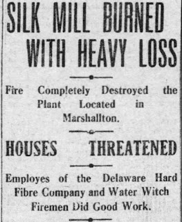
November 15, 1911 headline of
the burning of the silk mill
From its inception in the 1830's through the remainder of the 19th Century and well into the 20th Century, the Village of Marshallton was always a mill town. The primary employer, of course, was the iron mill (later the fibre mill, later the Haveg and Ametek plant), but the woolen mill just to the south at Kiamensi was also a large Marshallton-area employer. While those two establishments put Marshallton men (and women...and children) to work for generations, for a short while there was actually a third, smaller mill operating in Marshallton.

From 1906 until 1911, and then possibly for a spell in 1914, the Marshallton Silk Mill was a source of employment for several dozen area residents. Although it was never as large or as long-lasting as the other two, for a time it was a significant employer in the area. And while there's not a whole lot that seems to be known about the operation, one thing I do know is that the story of the Marshallton Silk Mill is inextricably linked to that of its founder and owner -- George Washington Spicer, Jr.

George W. Spicer was born in June 1859, probably in Leipsic, Kent County, and grew up in Little Creek Hundred just north of Dover. His father was a merchant (listed as a Confectioner in 1860, at a feed store in 1870, and a grocer in 1880), so young George was probably never pulled into the farming life that the majority of his peers of that era were. He likely helped out in his father's stores when he was young, soaking up all the talk and gossip that came in with the patrons. And being near Dover, George may have heard a lot of political talk, stoking an interest he'd pursue passionately later in life.

I'm not sure what his connection was or why he ended up here, but by 1880 George Spicer was residing as a boarder in a home in Marshallton, and working at the Kiamensi Woolen Mill. His situation would change the following year, when in July 1881 he married Laura McGonigal, also of Kent County. The couple settled in Marshallton, and in November 1882 Spicer made a purchase that would set the rest of the story in motion. He bought from Vincent G. Flinn 19.67 acres of land on the southwest side of Newport Road and east of Red Clay Creek, much of which is now Washington Heights. 

Thursday, March 23, 2023

The Eastburn-Bell Farm

The c.1830 Joseph Eastburn Barn
When the original land grants and patents were given out for Mill Creek Hundred in the late 17th and early 18th Centuries, the tracts were often fairly large -- more likely to be in the 1000 acre range than the 100 or smaller that would be more common by the 19th Century. Over time, through divisions within families and sales outside of them, these large farms were broken up. Only very occasionally were these smaller farms later remerged to form larger ones, and only in a few rare instances were very large estates formed in MCH. Usually they were done by du Pont-related people, and one of those large estates is now largely state-owned parkland.

In the late 1920's the Equitable Trust Company began buying up farms in northwest MCH, around the Corner Ketch/Milford Crossroads area, for an anonymous client. In February 1930, it sold all the properties in bulk to the now not-so-anonymous Samuel Hallock du Pont in an extensive 15 page deed that included 36 separate properties (and one other deed involving a farm partially in DE and partially in PA). S. Hallock du Pont was creating an estate he called Whiteley Farm for use for himself and his family for recreation and hunting. Some of the farms that comprised it dated back to the earliest days of English habitation in the area, while others were newer, smaller ones carved out more recently. One in particular has been mentioned in passing in a couple of prior posts, but now we'll look at it in more detail.

The farm in question is located on Pleasant Hill Road, just south of Corner Ketch Road and west of Paper Mill Road. It may have once been the site of an early 18th Century home, probably later replaced in the 19th Century, but now only a c.1830 stone barn remains of the working farm. When du Pont acquired it in 1930, the farm was about 93½ acres, but it had once been part of a larger tract which was pared down several times.

Thursday, February 23, 2023

Camp Wright

The Arts and Crafts/Bunk House, with
Bunk House #2 in the background
To be sure, there are lots of sites (standing and gone) in Mill Creek Hundred that were special to various grown-ups over the years -- the homes where they raised their families, the mills or barns where they spent their days, the churches they worshiped in. But there are three MCH sites in particular that come to mind as holding a special place in the hearts of thousands of children -- Brandywine Springs Amusement Park, Camp Mattahoon, and the subject of this story, Camp Wright. We've covered the first two in previous posts, so now we'll give Camp Wright its due.

What became known as Camp Wright sits on a seven acre tract along the west side of Mill Creek Road, across from the end of Graves Road (and just south of Mendenhall Mill Road). For nearly 80 years it served as a pastoral oasis for thousands of Wilmington's underprivileged children, if only for a week or two at a time. Speaking of the site, one article in 1929 said, "Perhaps there is no spot in Delaware where there is more happiness confined in a small space than at the Children's Camp near Hockessin." And though Camp Wright is a part of the 20th Century history of Mill Creek Hundred, its origins go through Brandywine Hundred and ultimately back to post Civil War Wilmington.

In the aftermath of the war, benevolent and special aid societies popped up all over the country, so many that by the 1880's there began to be some consolidation of these charitable organizations. Locally in 1884, several of these groups merged to form the Associated Charities of Wilmington, with the goal of better coordinating services for the city's underprivileged. One of the programs, which began in 1889, was the idea of sending poor city kids (and their mothers) to spend time "out in the country". This soon morphed into the idea of summer camps for children, which: 1) gave them rural experiences, 2) got them out of the unhealthy city for a time, 3) allowed them access to better food and exercise, 4) and not least of all, gave their parents a break, too.

Monday, February 6, 2023

The Samuel Hanby Brown House

The Samuel H. Brown House in Talleyville
In this post we're going to travel out of Mill Creek Hundred to visit Brandywine Hundred, and more specifically, Talleyville. This story functions both as a follow-up to the posts a while back about the Taylors (here and here) and as my own little memorial. The owner of the house we'll eventually be looking at -- Samuel Hanby Brown -- was married to a member of the Taylor family. One of their grandsons happens to have been my father-in-law, who we recently lost. This story's for you, Dave.

The house in question no longer stands, but I'm sure that many of you have passed right through where it once was. And though the story will end in Talleyville (the area around Concord Pike (Rt. 202) and Silverside Road), we'll begin a few decades earlier, in Christiana Hundred. That was where, in the 1840's, the eponymous Samuel Hanby Brown's great grandfather Joseph Brown owned and worked his 85 acre farm. It was situated just north of Mt. Cuba, right where the Fieldstone Golf Course is today. Since I was curious, I decided to take a quick, simple look into when the family might have first arrived on this particular farm. The search ended up being neither quick nor simple -- but it was very informative (and I ended up possibly pushing my wife's family tree back to her 7th great grandfather).

Since these things tend to be more clear going forward in time, we'll jump back to 1750 to begin our abbreviated trip though the history of the tract. That's the earliest I've been able to prove that a man named William Kirkpatrick owned a farm in Christiana Hundred. With the help of several wonderfully detailed deeds, we know that in 1788, 150 acres of the recently deceased Kirkpatrick's land was granted to Ann Wallace (presumably his daughter). By 1792, Ann's husband Thomas Wallace had died and she sold the tract to William Johnston, who is stated to be her son (by a previous marriage?). William Johnston died in 1834 without a will, and his real estate then passed to his only child, Ann. Back around 1815 or so, Ann had married Joseph Brown.

Friday, January 6, 2023

The Samuel Stroud House

Part of the original log house
(Photo courtesy Ruth Clancy)
This story might seem like a follow-up to the recent guest post from Charles Stroud Gawthrop documenting the Stroud family. But, in one of those little coincidences I love, I had actually been thinking about and looking into this property before Charles reached out to me. In fact, when he did, it took me a moment to even realize they were connected. And I wouldn't have even known in the first place that this house had survived into "modern" times if it weren't for information passed on to us a while back from Ruth Clancy.

We'll get to the end of the line for the house (and Ruth's recollections of it) shortly, but frustratingly I know a good bit more about its end than I do its beginning. I found details about the creation of the particular farm that the house anchored, and about its ownership for more than a century. What I've been thus far unable to find are specifics about the early ownership of the land and about who might have built the house and when. But let's start with some basic facts, like just what the heck I'm talking about and where.

The 120 acre farm owned by Samuel Stroud and his descendants is now (and has been since 1950) a part of the grounds owned by Delaware Park. More specifically, most of the farm is now a part of the White Clay Creek Country Club golf course. The property is bordered on the south by the railroad tracks (which were new at the time the tract was laid out), on the west by a small stream, and on the north by a combination of White Clay Creek (the western part) and the Byrnes Mill race (towards the east). The farmhouse stood just above the railroad tracks in the middle of the larger, western portion -- right where the clubhouse and At the Rail Restaurant is located.