If you appreciate the work done on this blog, please consider making a small donation. Thank you!

If you appreciate the work done on this blog, please consider making a small donation. Thank you!

Thursday, March 23, 2023

The Eastburn-Bell Farm

The c.1830 Joseph Eastburn Barn
When the original land grants and patents were given out for Mill Creek Hundred in the late 17th and early 18th Centuries, the tracts were often fairly large -- more likely to be in the 1000 acre range than the 100 or smaller that would be more common by the 19th Century. Over time, through divisions within families and sales outside of them, these large farms were broken up. Only very occasionally were these smaller farms later remerged to form larger ones, and only in a few rare instances were very large estates formed in MCH. Usually they were done by du Pont-related people, and one of those large estates is now largely state-owned parkland.

In the late 1920's the Equitable Trust Company began buying up farms in northwest MCH, around the Corner Ketch/Milford Crossroads area, for an anonymous client. In February 1930, it sold all the properties in bulk to the now not-so-anonymous Samuel Hallock du Pont in an extensive 15 page deed that included 36 separate properties (and one other deed involving a farm partially in DE and partially in PA). S. Hallock du Pont was creating an estate he called Whiteley Farm for use for himself and his family for recreation and hunting. Some of the farms that comprised it dated back to the earliest days of English habitation in the area, while others were newer, smaller ones carved out more recently. One in particular has been mentioned in passing in a couple of prior posts, but now we'll look at it in more detail.

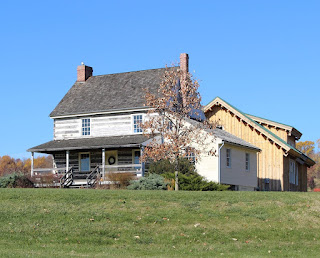
The farm in question is located on Pleasant Hill Road, just south of Corner Ketch Road and west of Paper Mill Road. It may have once been the site of an early 18th Century home, probably later replaced in the 19th Century, but now only a c.1830 stone barn remains of the working farm. When du Pont acquired it in 1930, the farm was about 93½ acres, but it had once been part of a larger tract which was pared down several times.

Thursday, February 23, 2023

Camp Wright

The Arts and Crafts/Bunk House, with
Bunk House #2 in the background
To be sure, there are lots of sites (standing and gone) in Mill Creek Hundred that were special to various grown-ups over the years -- the homes where they raised their families, the mills or barns where they spent their days, the churches they worshiped in. But there are three MCH sites in particular that come to mind as holding a special place in the hearts of thousands of children -- Brandywine Springs Amusement Park, Camp Mattahoon, and the subject of this story, Camp Wright. We've covered the first two in previous posts, so now we'll give Camp Wright its due.

What became known as Camp Wright sits on a seven acre tract along the west side of Mill Creek Road, across from the end of Graves Road (and just south of Mendenhall Mill Road). For nearly 80 years it served as a pastoral oasis for thousands of Wilmington's underprivileged children, if only for a week or two at a time. Speaking of the site, one article in 1929 said, "Perhaps there is no spot in Delaware where there is more happiness confined in a small space than at the Children's Camp near Hockessin." And though Camp Wright is a part of the 20th Century history of Mill Creek Hundred, its origins go through Brandywine Hundred and ultimately back to post Civil War Wilmington.

In the aftermath of the war, benevolent and special aid societies popped up all over the country, so many that by the 1880's there began to be some consolidation of these charitable organizations. Locally in 1884, several of these groups merged to form the Associated Charities of Wilmington, with the goal of better coordinating services for the city's underprivileged. One of the programs, which began in 1889, was the idea of sending poor city kids (and their mothers) to spend time "out in the country". This soon morphed into the idea of summer camps for children, which: 1) gave them rural experiences, 2) got them out of the unhealthy city for a time, 3) allowed them access to better food and exercise, 4) and not least of all, gave their parents a break, too.

Monday, February 6, 2023

The Samuel Hanby Brown House

The Samuel H. Brown House in Talleyville
In this post we're going to travel out of Mill Creek Hundred to visit Brandywine Hundred, and more specifically, Talleyville. This story functions both as a follow-up to the posts a while back about the Taylors (here and here) and as my own little memorial. The owner of the house we'll eventually be looking at -- Samuel Hanby Brown -- was married to a member of the Taylor family. One of their grandsons happens to have been my father-in-law, who we recently lost. This story's for you, Dave.

The house in question no longer stands, but I'm sure that many of you have passed right through where it once was. And though the story will end in Talleyville (the area around Concord Pike (Rt. 202) and Silverside Road), we'll begin a few decades earlier, in Christiana Hundred. That was where, in the 1840's, the eponymous Samuel Hanby Brown's great grandfather Joseph Brown owned and worked his 85 acre farm. It was situated just north of Mt. Cuba, right where the Fieldstone Golf Course is today. Since I was curious, I decided to take a quick, simple look into when the family might have first arrived on this particular farm. The search ended up being neither quick nor simple -- but it was very informative (and I ended up possibly pushing my wife's family tree back to her 7th great grandfather).

Since these things tend to be more clear going forward in time, we'll jump back to 1750 to begin our abbreviated trip though the history of the tract. That's the earliest I've been able to prove that a man named William Kirkpatrick owned a farm in Christiana Hundred. With the help of several wonderfully detailed deeds, we know that in 1788, 150 acres of the recently deceased Kirkpatrick's land was granted to Ann Wallace (presumably his daughter). By 1792, Ann's husband Thomas Wallace had died and she sold the tract to William Johnston, who is stated to be her son (by a previous marriage?). William Johnston died in 1834 without a will, and his real estate then passed to his only child, Ann. Back around 1815 or so, Ann had married Joseph Brown.

Friday, January 6, 2023

The Samuel Stroud House

Part of the original log house
(Photo courtesy Ruth Clancy)
This story might seem like a follow-up to the recent guest post from Charles Stroud Gawthrop documenting the Stroud family. But, in one of those little coincidences I love, I had actually been thinking about and looking into this property before Charles reached out to me. In fact, when he did, it took me a moment to even realize they were connected. And I wouldn't have even known in the first place that this house had survived into "modern" times if it weren't for information passed on to us a while back from Ruth Clancy.

We'll get to the end of the line for the house (and Ruth's recollections of it) shortly, but frustratingly I know a good bit more about its end than I do its beginning. I found details about the creation of the particular farm that the house anchored, and about its ownership for more than a century. What I've been thus far unable to find are specifics about the early ownership of the land and about who might have built the house and when. But let's start with some basic facts, like just what the heck I'm talking about and where.

The 120 acre farm owned by Samuel Stroud and his descendants is now (and has been since 1950) a part of the grounds owned by Delaware Park. More specifically, most of the farm is now a part of the White Clay Creek Country Club golf course. The property is bordered on the south by the railroad tracks (which were new at the time the tract was laid out), on the west by a small stream, and on the north by a combination of White Clay Creek (the western part) and the Byrnes Mill race (towards the east). The farmhouse stood just above the railroad tracks in the middle of the larger, western portion -- right where the clubhouse and At the Rail Restaurant is located.

Tuesday, November 15, 2022

The Buckingham-Pierson House

The Buckingham-Pierson House today
When a house stays around for long enough, it usually will pass through a number of different owners. Normally it ends up being a combination of passing to various generations of the same family and being sold off to different families. One house in Hockessin, however, had the good fortune to remain in one family for over 260 years, although it took me a little while to realize that. The beginnings of the house and farm reach back to the earliest days of European habitation in the area, and its present and future look strong and secure.

The home in question is the Buckingham-Pierson House (or Thomas Pierson House), located on the north side of Southwood Road, about mid way between Valley Road and Limestone Road. The half stone and half frame house sits up on a rise, today overlooking modern housing developments. Once, it overlooked a 100 acre farm and even passing trains. Now a part of modern, beautiful Hockessin, the origins of the farm date back to the Penn family, when the community surrounding the Hockessin Valley was in its infancy.

In 1701, William Penn had a 30,000 acre tract (called the Manor of Stenning) surveyed by Henry Hollingsworth, lying mostly in Chester County but extending down into Mill Creek Hundred (the tract, not Hollingsworth). That same year Penn granted the western 14,500 acres to his son William, Jr. and the eastern 15,500 acres to his daughter Letitia. Letitia Penn married William Aubrey, and in the ensuing years they sold off portions of their holding. More importantly for our purposes, in 1725 they sold a 100 acre lot to a man named William Buckingham. Direct descendants of Buckingham's would retain ownership of the property until half way through the George H.W. Bush administration.

Wednesday, October 26, 2022

Guest Post -- The Strouds of Stanton, Delaware

I am always thrilled and proud to host Guest Posts here (if anyone wants to write something, let me know!), and this one is no exception. This particular installment focuses on the Stroud Family, several members of which had impacts on our region, most notably in the Stanton area. Our guest author, Charles Stroud Gawthrop, is a direct descendant of one of these Strouds who resided near Stanton, and whose home will be the focus of an upcoming post of its own. This well-researched account will help your understanding of the family and should help to put these Stroud Family members into better context for us. It's a great example of what amazing things can be accomplished even by someone who is admittedly new to historical/genealogical research. Many thanks to Charles for researching, writing, and sharing his work with us here! Enjoy! --- Scott


Headstone of Samuel Stroud, Jr.,
direct ancestor of the author

My name is Charles Stroud Gawthrop. A few years ago I was reading the The Mill Creek Hundred History Blog and there was a posting about the Stanton Hotel which mentioned James Stroud. Then there was the posting about the Stanton Mills mentioning Joshua Stroud - hmmm! So I started to do a little digging to see if I was related. I’m new to this genealogy thing. Prior to 2021, I had heard of Ancestry.com, but that was about it - so there was a lot to learn. Little did I know how addictive it is (and sadly how expensive Ancestry is). 

Yes, I am related to Samuel Stroud (brother of James and Joshua). Time went by and pieces of the puzzle were falling together, to a point that I realized I have some information to share.

One of the the things that impresses me about Scott Palmer, the webmaster for MCH history blog, is his ability to keep things light - a recitation of dates can be pretty boring - and that he publishes something about once a month! - so “keep it short”! So I have attempted to keep this light. There is so much more that I have missed. There is also the rest of the story - following the next generations. I have not even started that journey.

Monday, October 17, 2022

The Malcom-Burris-Weinstock Store

1904 receipt from G.W. & C. Malcom
This was a particularly fun little investigation that ended up being about something that was only around for about 50 years, and has been gone for more than 60. It did help uncover the beginnings of something that a few people may remember the end of. It started with a great find (not by me) that when I first saw it, I expected to go in a very different direction. It wasn't until most of the way through that the real story became apparent to me.

So, what are we talking about? Well, this all began when the keen eye of Denis Hehman came across an image of the handwritten receipt seen here, dating to February 11, 1904. On it, John Mitchell has purchased items from the establishment of G.W. & C. Malcom. What I think really caught Denis' eye was the fact that the location is listed as Marshallton. He was not familiar with the Malcoms and neither was I, so I started looking into them. However, the answers did not lead where I thought they would, and I ended up answering a question I didn't even know I had.

With the location of Marshallton and the description of "Manufacturers of and dealers in all kinds of mill feed and grain", I expected that they would be associated either with the Marshallton or maybe the Greenbank Mill. But since "Marshallton" could cover a wide area, I wasn't sure. I was pretty sure though that the Marshallton mill was out of service by 1904, so I looked more toward Greenbank, even though I'd never heard the Malcom name associated with it before. Turns out that I still haven't found this exact answer, but I did find lots of other ones.

Thursday, September 15, 2022

Tweed's Tavern

Tweed's Tavern today
When we hear “tavern” today, we think of a place to meet up with friends, have a few drinks, and maybe grab a good meal. Taverns in the 18th and 19th Century fulfilled those roles for locals as well, although their function did evolve a bit over time. In the 1700's, taverns primarily served as resting places for weary travelers.  At the time, Limestone Road served as an important transportation route for farmers bringing their crops down from the fertile fields of Pennsylvania to the shipping centers of Stanton and Newport. However, the roads were poor and travel was difficult, so resting places were never far apart.  At the roadside inn or tavern the traveler could get a hot meal (consisting of whatever the innkeeper happened to have), a bed (usually in a room with others and sometimes, especially in the winter, a bed shared with others), stables for his horses, needed repairs for his wagon, a few good stiff drinks, and all the gossip and news he could take in and share. In those days, taverns served as one of the main ways for news and ideas to spread.

While many 18th and 19th Century taverns were no more than family homes lightly outfitted to host guests, the establishment that would come to be known as Tweed's Tavern seems to have been built specifically as a tavern. But as well-documented as its later history is, the earliest years of the tavern have some frustrating holes. The history of the land goes back much further, of course, but for our purposes here we'll start in the 1790's. It's here that I have a quiet disagreement with some of the published histories. I've seen it written that in 1790, Brandywine Hundred native Stephen Foulk purchased 96 acres of land along the Limestone Road from John Gregg. Stephen was the younger brother of William Foulk, owner of the former Evans mill on Red Clay Creek that would later become the Fell Spice Mill.

The people are correct, but unfortunately the 1790 deed that's referenced (in a 1997 DelDOT report) is not available for me to see. What I have found is a December 1796 indenture tripartite between John Gregg, Stephen Foulk, and John Crow. Admittedly it's a little confusing to me, but it sure seems like Gregg is selling the 96 acres for the first time. I believe he's selling it to Foulk, but with a one year lease agreement between Foulk and Crow. [Thanks to our friend Walt C., I think we have an answer now. For the full explanation, check out his comment from 2/10/2023 down below. The short version is that this 1796 transaction was a sort of legal end-around to make sure the 1790 sale from Gregg to Foulk was legit and binding. I still feel it's not a coincidence that Crow was involved in this maneuver.]  The significance of this is that John Crow was a well-known innkeeper in New Castle and Wilmington, and is identified in the deed as an innkeeper. The prevailing thought is that it was Crow who built, on the northern end of the 96 acre tract, a two-story log house for use as a tavern.