 Long-time readers of this blog should be familiar with the name Walt Chiquoine. He has written several guest posts here, and for many years has been the go-to guy for decoding old land records, especially those from the Colonial Era. He has amassed enough data to map out the ownership of almost all of Mill Creek Hundred at the time of the Revolutionary War. While this may sound like an arbitrary (and possibly pointless) thing to do, there was, most certainly, a method to his madness.
Walt's not a native of the area, but after moving here in the 1980's he heard the stories of the British Army's movements in the region in 1777, leading up to the Battle of Brandywine. Eventually, a seemingly simple question got stuck in his head -- I wonder if the British marched near my house? From this one question has sprung years of research and so many hours down at the State Archives that I'm surprised they never gave him a parking spot. Or his own key. Or at least special bathroom privileges. Point is, he's put a lot of work into this. And over time, "this" has turned into several separate but related projects.
Much research was done into firsthand accounts of the British Army's movements during that time. From trying to understand this data came the project of mapping out the ownership of MCH during the 1770's. Finally, and tying everything down and putting it into place, was the finding of the often-mentioned but never located Daniel Nichols House, Gen. Howe's headquarters for two days while the army camped in MCH. Now, after years of work, I'm thrilled to say that Walt has released his work for public consideration.
I really need to tell you first, if you have any interest in this subject at all, to please follow this link and download Walt's work firsthand. Do yourself that favor and read him directly. (You'll need to quickly set up an account with Academia.edu, but it's quick and easy and most definitely worth it. And as a bonus, you'll have access to his papers on the Greenbank and Marshallton Mills, as well as his Mount Pleasant Inn paper.) His original papers are infinitely better than any short recap I can do. But for those who cannot download the original, or who want just a quick introduction to the topic, I'll attempt to give a good idea of what he's done over the next couple posts. The words here are mine, but the information and research is Walt's.
First, a quick refresher to set the stage. It was 1777, and the British had captured New York the year before. The next objective was Philadelphia, but instead of marching directly there, British General Sir William Howe decided to attack from the southwest. A combined British and German force of about 16,000 sailed for six long, hot weeks, down the East coast, around the Delmarva Peninsula, and up the Chesapeake Bay. They landed at Elk Neck (south of North East and Elkton) on August 25, in poor shape and low on provisions. A few divisions were sent foraging, but the main force marched north to Elkton then east towards Iron Hill in Pencader Hundred.
 |
| Movement from Elk Neck to Pencader |
Whether you were Patriot or Loyalist, the presence of the British was rather overwhelming to the locals from start to finish. Besides the troops [about 16,000], there were probably about 2,000 wives, servants, and laborers, about 275 wagons, and more than 2,000 head of livestock including horses (only a portion which had been paid for). The army generally occupied three to five square miles at any given time. Meanwhile, the entire population of Mill Creek Hundred was about 1500 people in 43 square miles, and probably half that population was minors.Both Howe and Washington knew that the ultimate goal was Philadelphia. The shortest and most direct route would have been east to Wilmington, then north through Chester to Philly. To block this route, Washington had his army put up a defensive line along Red Clay Creek near Cuckoldstown (Stanton). This part of the story was covered in a previous post. Of course as we know, Howe decided to flank the Continental's position to the north, leading to the September 11 Battle of Brandywine near Chadds Ford.
In the early morning hours of September 8, 1777, the British broke camp in Pencader. They split their forces into two groups -- one group (much better known and documented) heading north through Newark, and another, less documented, group heading east towards Christiana Bridge. The first contingent is usually what's described when you hear the traditional story of the march through MCH. One of Walt's great contributions to the narrative is a better understanding of the second group.
 |
| British movements into MCH, September 8, 1777 |
Part of Howe's 1st Division (including the General himself) marched through a deserted Newark, then proceeded north along the Paper Mill Road corridor. The road has changed alignment slightly since then, but it's more or less the same road you'd take today from Newark to Limestone Road. The 2nd and 3rd Divisions followed closely behind. It was the troops on this route who were responsible for the looting and attempted looting stories we've mentioned in prior posts, like the Boggs' family's patriotic bees and the ransacking of the McDaniel-Peach House. They eventually arrived that evening at the Limestone Road area, and General Howe made his headquarters in what has always been referred to as simply, "The Nichols House". It was the locating of this particular house by Walt that helped everything else fall into place regarding the placement of the British troops over the next several days. This will be detailed in the next post.
But meanwhile, as the bulk of the army was heading north, a portion of the 1st Division had broken off on the morning of September 8 and began heading east. These movements have been less documented over the years, but in his paper (which, again, can be found here) Walt makes several strong arguments showing that it indeed did happen. For one, the Continental army acted that day as if the enemy were headed for them. Daniel Byrnes, a boy at the time living nearby, later wrote about the British Army arriving at Christiana Bridge and then turning north. Another clue is a flag captured from a home more or less on the way.
A final big clue, and one that likely helps pin down the site of the army's entry into MCH, comes through the Morrison family. As Walt notes, a history of the family published in 1880 states, "During the Revolutionary War the family homes were in the line of march of the British Army, when their goods and much of the family records were destroyed." The Morrison farm was located on the south side of White Clay Creek, just east of the Rotheram, or Harmony, Mill. In fact, I believe one of the old Morrison homes is still standing (in a modified form) in the development of Brookhaven.
These troops would have forded the White Clay and headed north towards Limestone Road. If they marched in a more or less straight line, they would have gone through what's now the developments of Green Valley and Meadowood, through the All Saints Cemetery/St. Marks High School properties, across the area of The Highlands, Skyline Middle School and Skyline pool, and finally through Carousel Park. Of course, they could have deviated some from this path and extended to either side, but ultimately they did arrive and camp just north of Milltown. Where exactly all these troops encamped will be addressed in the next post.
 |
| Weedon's approach to the British line across Mill creek |
As one final note, you'll notice from these accounts that there's a lot of marching, but not much (aside from the skirmishes near Cooch's Bridge) shooting. While it's true that the Battle of Red Clay never materialized and there was no actual battle in MCH, there was one incident that could, generously, be called an engagement. Sometime during the day of the 8th, Gen. George Weedon was dispatched with a brigade to "bring on the attack". They marched to a hillside near Red Clay Presbyterian Church and observed the enemy across the creek, waiting for an attack to come. None did, but a few shots were fired across the valley, likely in the area around Mill Creek Road and Stoney Batter Road. As Walt notes (and anyone who's every driven there can attest), the hillsides climb rapidly on both sides of Mill Creek there.
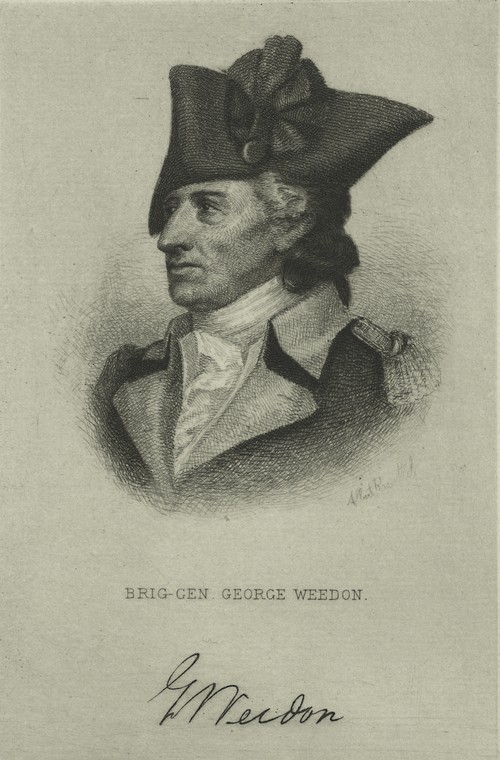 |
| Gen. Weedon, Hero of the Battle of Mill Creek (Ok, yes, that might be pushing it) |
Nice work Walt. I wish I could find a connection by blood to the "Delaware Branch" of the Morrison of White Clay Creek. https://books.google.com/books?id=rxkaAAAAIAAJ&dq=history+of+the+morison+or+morrison+family&printsec=frontcover&source=web&ots=agFGcp_r0E&sig=HIP7Jvk7Be5Y5r8thX2gAAbcMLI&hl=en#v=onepage&q=delaware&f=false
ReplyDeleteRich Morrison