If you appreciate the work done on this blog, please consider making a small donation. Thank you!

If you appreciate the work done on this blog, please consider making a small donation. Thank you!

Wednesday, July 27, 2011

What's the "Hundred" in Mill Creek Hundred?

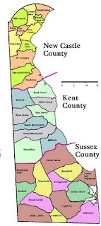
A couple weeks ago I was talking to a friend who lives out of state, and he asked me what seems like it should be a fairly simple question: "What does "Hundred" mean, in "Mill Creek Hundred"? For those of us who have lived for an extended time in Delaware (especially New Castle County), we're probably used to hearing "Mill Creek Hundred", or "Brandywine Hundred", but we may not think much about where the term comes from. I've actually sidestepped this post for this long because there really isn't a good, simple answer to the question. Or, there is a simple answer, but it's not good enough. Or, there's several good answers, but none of them are exactly right ... but none of them are completely wrong. Sometimes, thinking too hard about a word only serves to confuse things. But, I've come this far, and never let it be said that I'm not willing to try to confuse things even more.

We'll start with what should be the simple answer to the question of "What is a Hundred?" -- It's an old English political unit, smaller than a county or shire. Even this, though, is not quite exactly accurate. Besides England, equivalents to hundreds have been used in parts of Finland, Norway, Sweden, Denmark, Germany, and Australia. Their use in England dates back to at least the 900's, but were probably in use long before that. The ultimate origin of the term may date back almost 2000 years to Teutonic armies, and their custom of dividing their armies into groups of 100 men from a given area. When Teutonic tribes invaded England in the 5th and 6th Centuries, the division of land and the invader's settling patterns may have been influenced by these "hundreds" of warriors.
Thursday, July 21, 2011

The Bailey Family

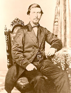
Samuel A. Bailey
Sometimes the most enjoyable research is the stuff that comes out of the blue, and ends up somewhere you never thought it would go. A few days ago, commenter M.S. left a few stories and a few questions over on the Forum, so I decided to take what I thought would be a quick look and give a quick answer. The innocent question that sent me off involved an old woman named "Miz Bailey", who the commenter's brother remembered as living in an old house in the woods near Hercules Road and Newport Gap Pike. I figured that if I was lucky, I might be able to find her in a census and uncover her full name. I didn't expect, however, to be digging back over 200 years, and clearing up a few questions about some old maps along the way.

To get right to the answer to the question first, "Miz Bailey" was in fact Margaret Mabel Bailey, who died unmarried in 1953. The house in which she lived her entire life, and which never had electricity, was located a few hundred yards east of Newport Gap Pike, and south of Hercules Road. I can't be sure exactly what house she was residing in, but it's likely that it was one that had been in her family for well over 100 years by the time of her death. The Bailey family's history in Mill Creek Hundred goes back even further, at least three generations prior to Mabel and 150 years before her passing.

Monday, July 18, 2011

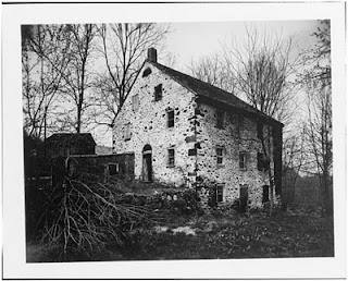
Early History of the Mendenhall House

I feel I need to apologize in advance for the possibility that this post will read as being a bit disjointed and rushed. Frankly, I need to just write it before I get too frustrated and give up. When I write a post, I generally like to answer more questions than I raise, but sometimes it doesn't work out that way. This is one of those times. Two previous posts (here and here) have looked at the Mendenhall family and their holdings along Mill Creek, but since the writing of the recent post, new information has been presented to me regarding the house overlooking the Mendenhall Mill/Mill Creek Road intersection. There are tantalizing clues as to the early history of the house, but unfortunately few concrete answers. What I'll do here is present what we know, what we believe to be true, and the questions that have yet to be answered. My hope is that someone else out there may have the key to unlocking this mystery.

Thursday, July 14, 2011

Mendenhall House and Mill Revisited -- Additions and Corrections


James Mendenhall's 1826 Mill
A while back, I did a post about the Mendenhall House and Mill located around the intersection of Mill Creek Road and Mendenhall Mill Road. While I still think that most of what is in the post is correct, and it was all written with the best information I had at the time, I have come across new information that sheds new light on the early history of the area, and a little on the later history. One of the reasons I started writing this blog originally was to document my own journey of exploration through the history of the Mill Creek Hundred area. And like many journeys, this one sometimes heads the wrong way. I want to use this post to clear up some of the things that I now know I got wrong, and to add some more information to the story.

The first place to start, I guess, is at the beginning of the Mendenhall story, and to state that I now know that it wasn't really the beginning. In the previous post, I had written that Aaron Mendenhall, Jr. (1729-1813) moved to Delaware about 1763, and settled first on a property known as Sugar Loaf Farm near Brandywine Springs. Then, about 20 years later, his son James A. Mendenhall (1763-1839) moved to the Mill Creek area and erected the first mill there. With the new information that I've found and was refocused to (thanks, Walt C.), I can now see that almost none of that is accurate. Contrary to what my wife thinks, I actually can admit when I'm wrong.

Sunday, July 10, 2011

Paper Mill and Faulkland Road Covered Bridges


Postcard showing the Paper Mill Covered Bridge
 I don't think it would shock anyone if I said that Mill Creek Hundred is chock full of creeks, streams, runs, and all manner of moving water (c'mon, "Creek" is right there in the name). And while these were certainly a blessing for millers and manufacturers, they sometimes got in the way when you were trying to get from one place to another. Very early in our history, there were no bridges on what passed for roads in the area -- you just forded the streams at a shallow spot. Later, bridges did begin to be built, but they were usually small, wooden, and in need of frequent maintenance and repair. In the early part of the 19th Century, a new type of bridge began to appear, one that would last longer and require less maintenance than earlier ones -- the covered bridge. At one time, MCH was dotted with at least a dozen or more covered bridges. Here, we'll look at two of them -- one of the longest, and probably the shortest.

The first bridge we'll look at was one of the last in the county to be intentionally taken out of service, and was to my eyes one of the most beautiful -- the Paper Mill Bridge east of Newark. The history of this bridge, not surprisingly, is closely tied to the nearby Meeteer (later, Curtis) Paper Mill. When the mill began operations in the late 1700's, there was no bridge here -- only a nearby ford, called Tyson's Ford. In 1817, the first bridge carrying what we now call Paper Mill Road over White Clay Creek was built. The cost was $1771.83 for the wooden, non-covered bridge. This bridge sufficed for the next 44 years, until it was replaced in 1861 by a 96 ft. Town lattice truss covered bridge ("Town lattice truss" was the style of bridge, the most common, especially in rural areas, since it could be built without metal fasteners).

Wednesday, July 6, 2011

Eastburn Store

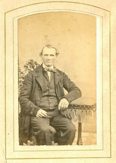
Isaac Eastburn (1806-1890)
In this blog, we've looked at a variety of different sites from life in Mill Creek Hundred in the 18th, 19th, and early 20th Centuries. We've seen houses, mills, hotels, churches, and even a resort and amusement park. There's one important community building of the time that we've yet to focus on, though, mostly because precious little survives of these outposts. I don't know if it comes from watching too many Little House on the Prairie episodes with my daughter and wondering how Mr. Oleson gets all his supplies and who he sells them to, but I've been interested recently in the small general stores that once served rural residents like those in MCH. Now, thanks to prompting from a question from a reader and local resident (thanks, Robin S), we'll take a quick look at one of those stores, owned by a member of a very prominent local family -- the Eastburns. As with most things, it seems, we don't have a complete picture of what went on, but we do have enough to get a general idea.

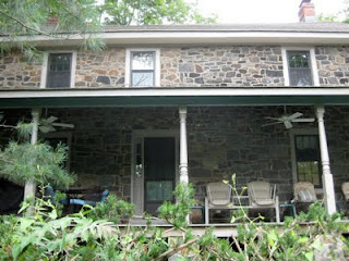
Just south of Corner Ketch, and north of the Paper Mill Road/Polly Drummond Hill Road intersection, there's a small little stub of a street called Pigeon Hollow Road. There are only about three or four houses on the street, but two of them are survivors from the era when the Eastburns controlled the region. There is a two-story stone house, with a large, newer addition on the rear; next to it is a longer, 1 1/2 story frame house. This second house, for much of the second half of the 1800's, was the site of the Eastburn Store (I don't know that that was what it was called, but that's how I'll refer to it).