 |
| Remains of the south and west barn walls |
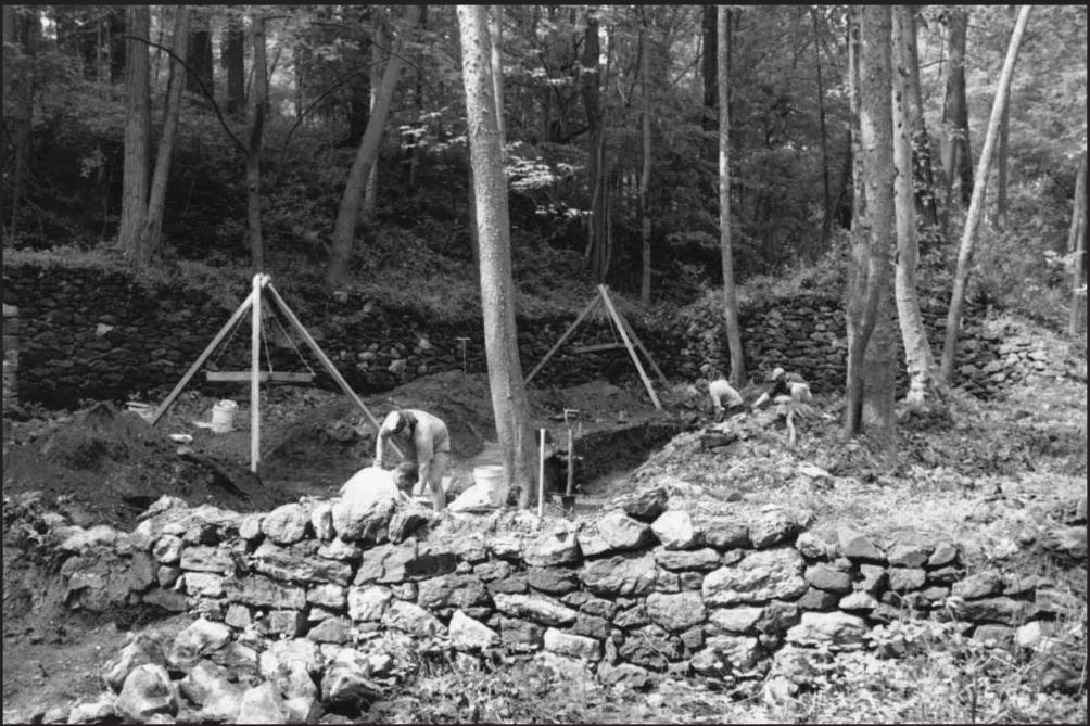
Finally, not long ago, I was able to get over to the site of the
Springer-Little Farm highlighted in the recent post. Along with good friend of the blog Walt Chiquoine, I went to take a look to see what is still there, and to see how it has changed since the 1998 excavations undertaken by DeDOT. It was only right to do this, since it was the presence of these ruins and being told about them that started all this in the first place.
The short version of the story is that yes, there are still structural remains there. Although it appears that the DelDOT team rightly back-filled much of what they had excavated, there are still three separate sites readily visible. I know what two of them are and I think I know the third. From what I can understand of the 1998 report, though, there are two main ruin locations that have disappeared. What makes being sure so difficult is that starting a few years ago, DelDOT began redacting the online versions of their archaeology reports, removing many of the maps and diagrams originally included. Specifically here, the online version (
which can be found here) is missing the maps showing the locations of the ruins relative to each other and to the road. However, with a careful reading and a better understanding of the site having been there, I think I know what's what.
 |
| Retaining wall seen close to the road |
We'll start with the two features that are, as best as I can tell, no longer present -- what the report calls the retaining wall and the outbuilding. The retaining wall was a stone wall that ran east-west along the northern edge of the property, along Old Coach Road. It can be seen near the top of the picture above. As best as I can tell, the outbuilding was located between the retaining wall to the east and the largest feature, the barn walls, to the west. While Walt and I were at the site, I could find no evidence of either the retaining wall or the outbuilding (although at the time, as I'll explain shortly, I thought I did). It seems like the outbuilding was situated to the northeast of the barn, close to the road.
 |
| Outbuilding wall in the foreground, barn in the background |
 |
| Interior of the barn, with the outbuilding in the upper right |
The 1998 photos above give a feel for where the outbuilding and barn where, in relation to each other. The top picture shows an outbuilding wall in the foreground and the barn in the background. The bottom shot was taken from atop the barn wall looking back, with the photographer standing about in the center of the top picture. One thing you'll notice is how close the ruins are to the road. I believe that when Old Coach Road was widened (the whole reason for DelDOT studying the site) many of these walls were either destroyed or buried. Today there is a steep hill along the roadside that is not evident in the 1998 photographs. I think when the road was widened the roadside was built up and filled in, possibly burying some of the ruins and hiding them from sight. This is a shame, since it was under one of the outbuilding walls that the archaeologists found what they believed to be the filled-in basement of the old, log Springer House.
The next feature, which has already been mentioned several times, is the barn. These walls, the largest still standing, are on the west end of the site. There are, however, fewer visible now than there were 18 years ago. The east end of the barn's southern (away from the road) wall looks similar to how it did then, as evidenced by the almost identical shot I took to one from the report (see below). This end hasn't sen much change.
 |
| South wall of the barn, in 1998 and 2016 |
However, the west end looks very different than how it did during the height of the dotcom boom. If you look again at the earlier picture with the outbuilding wall in the foreground, in the background you can see the west gable end wall of the barn extending to the right of the shot. The roadway is
just out of frame there. Today the western end of the barn just sort of fades into the hillside, with no evidence that I could see of that large western end wall. I think that it, too, fell victim to the road widening.
 |
| West end of the barn, no wall apparent |
East of the barn we found another set of ruins, seen in the photo below. As I noted before, I didn't have any diagrams showing where the different features were, so at first Walt and I were unsure exactly what it was that were looking at. I thought at first that it was the outbuilding, since the report said the house ruins were toward the south and mostly outside of the area of study. We walked up the hill several times looking for other ruins, but found none. It was Walt who first came to think that this might be the ruins of the c.1860's house, possibly built by James Ward and occupied for years by the Little family.
 |
| Remains of the Little House basement |
Unfortunately, the DelDOT report doesn't include any photos of the house site, but there is a sketch of what is unmistakably the wall on the left side of my picture. It's a bit hard to see in the picture, but just to the left of the large tree in the middle lie the remains of a concrete pad. The pad has a pattern of nominally one foot squares on it, and may have been a patio of some sort. As you can see in the photo and as the report notes, there is no evidence of a north wall, which would be closest to the camera. This may have been a basement foundation with a frame wall. The house is built into the hillside, so this may have been like a walk-in basement.
 |
| The spring house |
The final set of ruins is the only one which Walt and I did not approach closely, owing to the fact that it was down a steep hill and neither of us felt like having to walk back up. This was the spring house, and it is located east of the other sites and close to Pike Creek. In the 1998 report they noted finding a still-active spring inside, and I have no reason to think it isn't still there. Like the other ruins still standing, there isn't much of the spring house left. However, they're all still a pretty cool collective reminder of an earlier, more rural Mill Creek Hundred.


On an unrelated note, I noticed something interesting today. While driving North on Paper Mill Road, I looked over to my left and notice what looked to be a tiny old stone bridge about 50ft from Papermill road on the lefthand side, almost in someones backyard of the Grantchester neighborhood, (by Korner Ketch road) going over a little tiny gully or stream, (more so a ditch). I checked on the old maps and it looks like there was an old road there dating back to the 1937 map that lead to an old house, a farm I'm assuming, that was in the center of what would now be Grantchester. I never knew about this one.. It's interesting how much more you can see while the greenery isn't all grown over.
ReplyDeleteI think this is probably the bridge mentioned in the second part of the post that Dave Olsen did a couple of years ago (Remnants of Old Roads and Bridges...). It's amazing how much stuff you see once you start looking for it. And you're right, this is about the best time of year to find these things, before they start getting overgrown again.
Deletehttp://mchhistory.blogspot.com/2013/12/remnants-of-old-roads-and-bridges-old.html
Ah yes that's it! Thank you!
Delete